Washington County Durham
HOME WHAT'S WHERE BLACKFELL SANATORIUM
Memories of ...
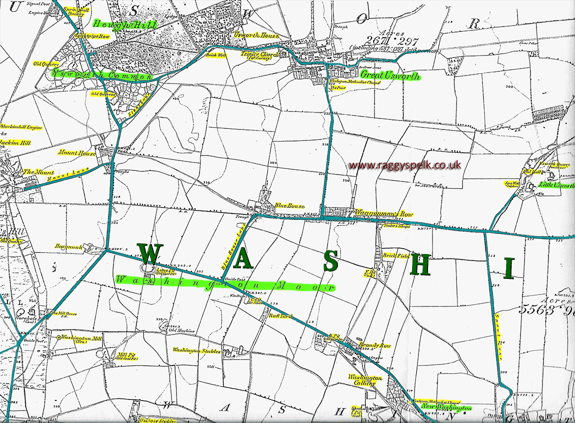
Washington Moor (1763 & 1858)
Washington Moor - 1858
Washington Moor - 1763
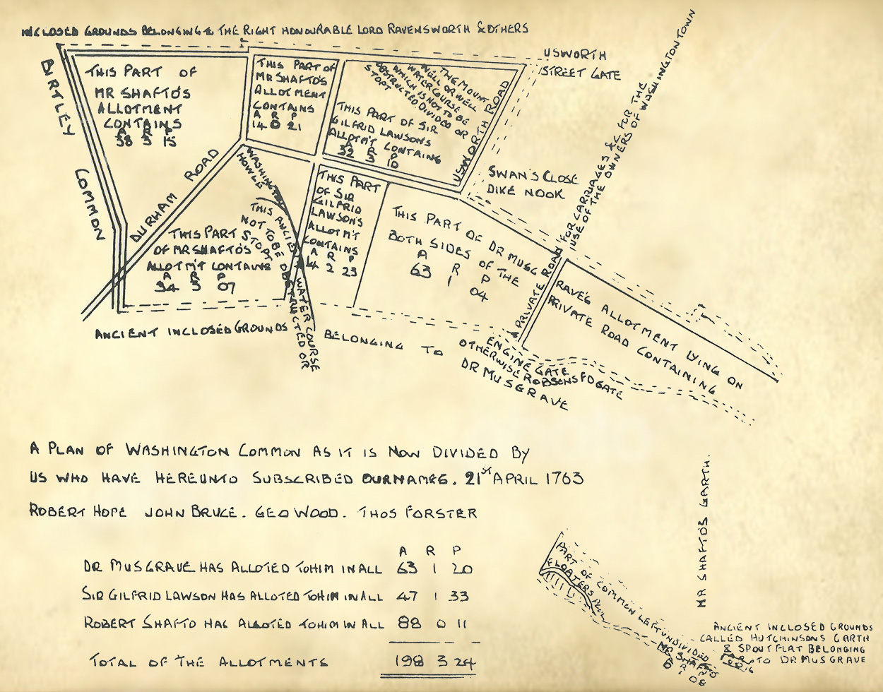
About the 1763 Map
A similar road, path & field layout can be be seen in the bottom-left area of both the above maps. Note the 3-way road junction.
The easterly road became Village Lane and the road marked 'Usworth Road' is where Havannah Terrace was built.
On 21st April 1763 the common land of Washington Moor was divided between three local families: the Shaftos, Musgraves and Lawsons.
Each family's allocation is written on the map e.g. Dr Musgrave received 63 Acres, 1 Rood & 20 Square Perches.
1 Acre = 1 furlong (220 yards) x 1 chain (22 yards) = 4,840 square yards.
1 Rood = 1/4 of an Acre = 1,210 square yards. (There are 4 Roods in 1 Acre)
1 Square Perch = 1/160 of an Acre = 30.25 square yards. (There are 40 Square Perches in 1 Rood)
Add up the 'P' column: 20 + 33 + 11 = 64. That's 1 Rood + 24 Square Perches, so write down 24 and carry 1 to the 'R' column.