Washington County Durham
HOME WHAT'S WHERE KEITH'S SPRINGWELL POSTCARDS
Memories of Fatfield & Harraton
Keith Cockerill's Postcards - Drawings of Albert L. Hind
- Book Cover
- Girdle Cake Cottage
- Biddick Inn / Worm Hill
- Havelock Arms
- Biddick Burn
- Shoemaker's Shop
- Old Mill House
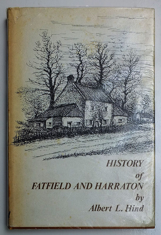
History of Fatfield and Harraton
( Published 1974 )
This Article contains Drawings by Local Author, Albert L. Hind.
Albert lived at Brookside on Biddick Lane, Fatfield.
IMAGES IN THIS ARTICLE
"Six Postcard Images featuring drawings by Albert L. Hind which were originally in his Book of 1974, History of Fatfield and Harraton.
There are many more drawings in the Book, but the Postcards came to me in a group of six, so there may be more in the series.
The Postcards, printed by B.J. Hewitson (printers) Coxhoe, Durham, are marked up copyrighted to Albert L. Hind.
Each Postcard rear says, the 'Drawing' has been taken from the Book, History of Fatfield and Harraton."
"There are no descriptions of the drawings on the Postcards but there are respective descriptions in the Book.
These 'Book Descriptions' have been placed, as a caption, under each individual Drawing."
Front Cover, 'Postcard Drawing' images and comments
contributed by owner, Keith Cockerill.
History of Fatfield and Harraton
Drawing by Albert L. Hind
Contributed by Keith Cockerill from his Postcard Collection.
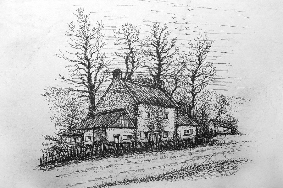
Girdle Cake Cottage
BOOK DESCRIPTION
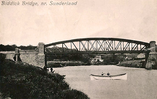
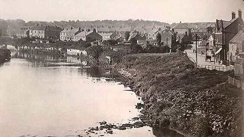
Fatfield Bridge, looking downstream to Girdle Cake Cottage.
[ Previously known as Biddick Bridge and/or Penshaw Bridge. ]
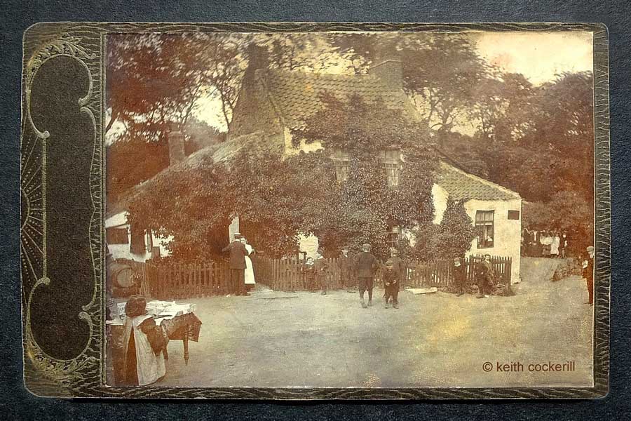
Mrs Batey's Girdle Cake Cottage and Tea Rooms (Pre-1900)
This is not a postcard, it's an original photographic print. The Photo is attached to an embossed backing card.
Some printer's finger marks are just visible on the road in the bottom-right corner.
( Photograph & Information contributed by owner, Keith Cockerill. )
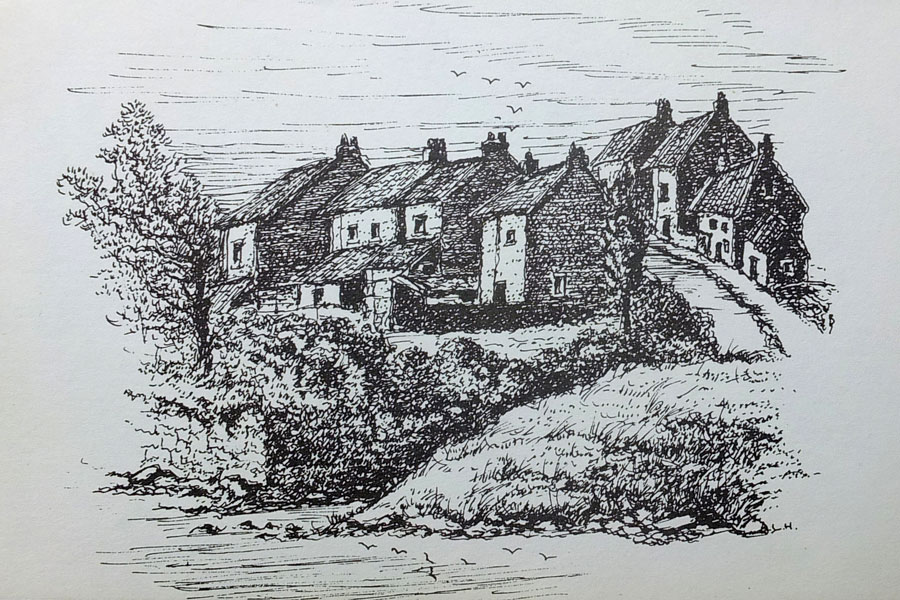
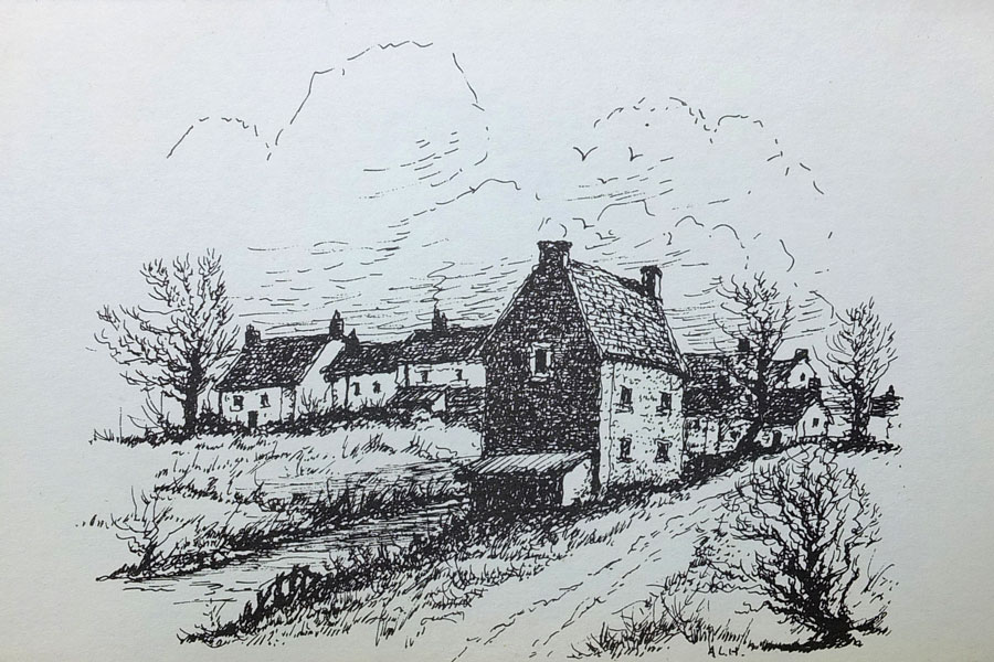
History of Fatfield and Harraton
Drawing by Albert L. Hind
Contributed by Keith Cockerill from his Postcard Collection.
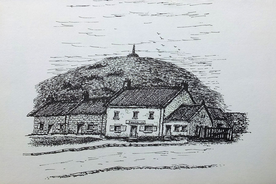
Biddick Inn and Worm Hill, 1930.
BOOK DESCRIPTION
Fatfield Bridge, is a few metres downstream.
[ off-picture, right ]
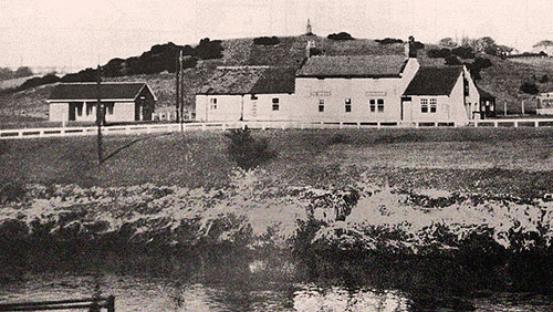
History of Fatfield and Harraton
Drawing by Albert L. Hind
Contributed by Keith Cockerill from his Postcard Collection.
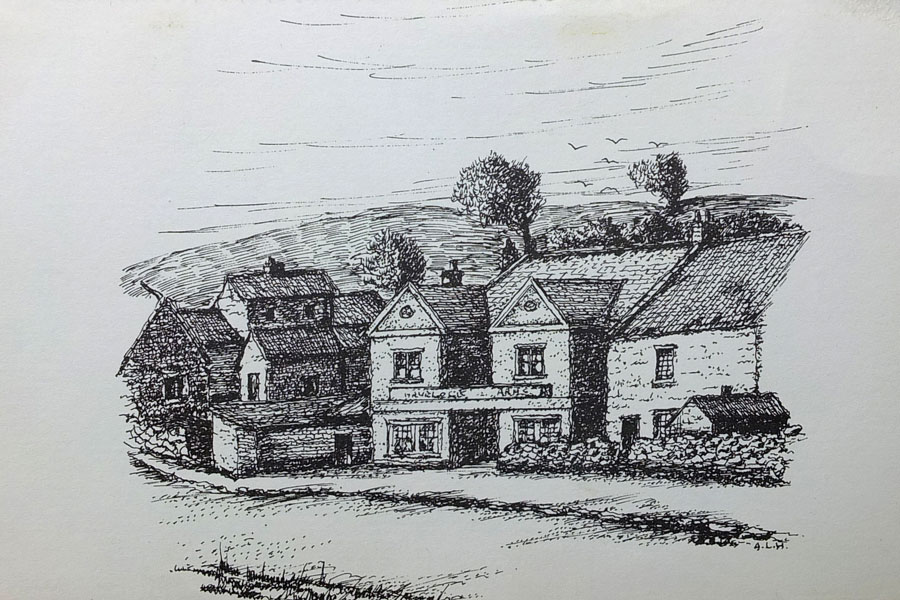
Havelock Arms, Nicholson's Buildings and the Hut - Alec Glasgow's Barber Shop, 1924.
BOOK DESCRIPTION
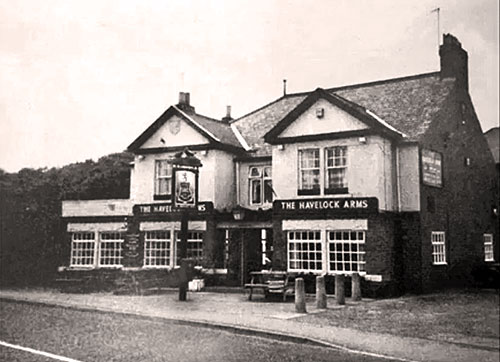
The Havelock Arms on Bonemill Lane
[ Biddick Inn is 200m, off-picture, right ]
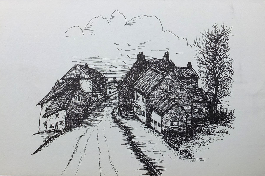
History of Fatfield and Harraton
Drawing by Albert L. Hind
Contributed by Keith Cockerill from his Postcard Collection.
Where the Biddick Burn enters the River Wear, 1924.
BOOK DESCRIPTION
Biddick Burn passes under Bonemill Lane at bottom of bank.
History of Fatfield and Harraton
Drawing by Albert L. Hind
Contributed by Keith Cockerill from his Postcard Collection.
Tom Oswald, Shoemaker. His Shop was handily situated in the Centre of the Village.
BOOK DESCRIPTION
Biddick Burn passes under road just beyond the Havelock Arms.
[ River Wear, off-picture, left ]
History of Fatfield and Harraton
Drawing by Albert L. Hind
Contributed by Keith Cockerill from his Postcard Collection.
Old Mill House Fatfield, 1910. (charcoal)
BOOK DESCRIPTION
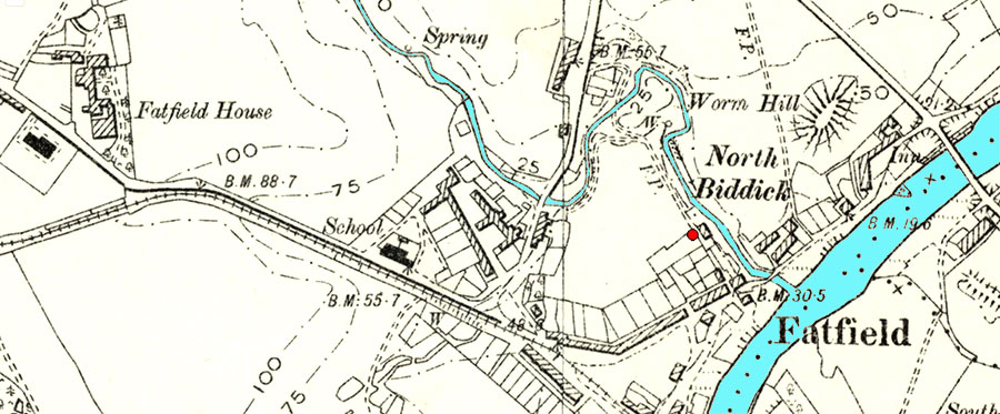
MAP: OS 25 inch, 1892-1914
"The Newcastle.gov.uk Website states that Fatfield (Charcoal Producing) Mill stood at Map Reference NZ 309 539.
After consulting a modern Ordnance Survey map showing Biddick Burn, I've identified that point.
The Red Dot locates the bottom-left-hand corner of a 100m x 100m square plot of land.
Note the Footpath and Building between the Red Dot and Biddick Burn.
Other items of interest: Waggonway from Harraton Colliery, Fatfield School, Biddick Lane, Biddick Inn & Fatfield Bridge."
{ Jim }
[ Keith, a Washington resident for over 40 years, is a Local Historian and Author of several books relating to Sunderland and the River Wear. ]