Washington County Durham
HOME WHAT'S WHERE
Memories of Washington
What's in a Name? Spout Lane / New Road
THE BROOK THROUGH WASHINGTON VILLAGE
SPRINGWELL to RIVER WEAR,
via THE SPOUT.
Originally written by Hutchinson for his,
'History of Durham', Volume II.
Faithfully reproduced by Frederick Hill for his 1929 local history book,
'History of Washington Parish Church', Part 1.
( Northumberland Press, 1929. )
N.B. The 'Old Church' was later replaced by Holy Trinity.
[ Thanks to Keith Cockerill for supplying the above extract from his personal copy of Frederick Hill's book. ]
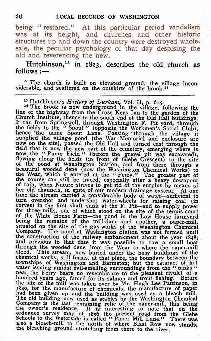
Mr Hill in Holy Trinity Church
( Audrey Fletcher's washingtonlass.com )
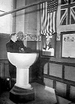
Headmaster Frederick Hill
(1885 - 1955)
[ More on Mr Hill at: What's Where; People; Hill, Frederick. ]
• • ◊ • •
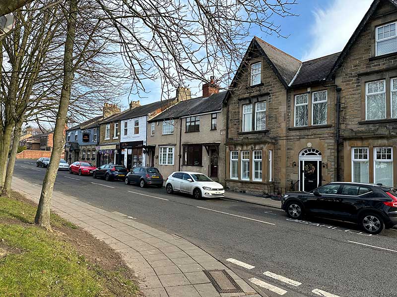
FACING THE SPOUT
The Workmen's Social Club
QUOTATION From PAGE 20, above.
"It ran from Springwell, through Washington 'F' Pit yard, through the fields to the 'Spout'
(opposite the Workmen's Social Club), hence the name Spout Lane."
• • ◊ • •
A 'NEW ROAD' REMOVES LARGE KINK IN THE ORIGINAL SPOUT LANE
( See Maps Below )
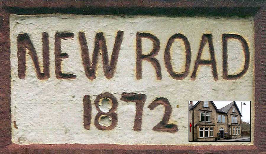
This Road Sign is above the Red Arrow.
Spout Lane / New Road, February 2023 - Still displaying the 1872 'New Road' Sign
[ Thanks to Photographer Ernie Guy, Member of Washington History Society ]
• • ◊ • •
A BUSY SPOUT LANE
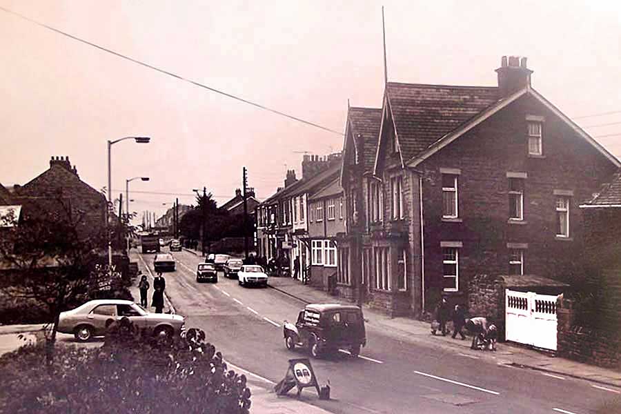
Washington & District Workingmen's Social Club
( Known to the locals as 'The Middle Club' and decades later 'The Teachers' Club'. )
• • ◊ • •
EXTRACT FROM OS MAP 1857
Village Lane, Spout Lane and Washington Village
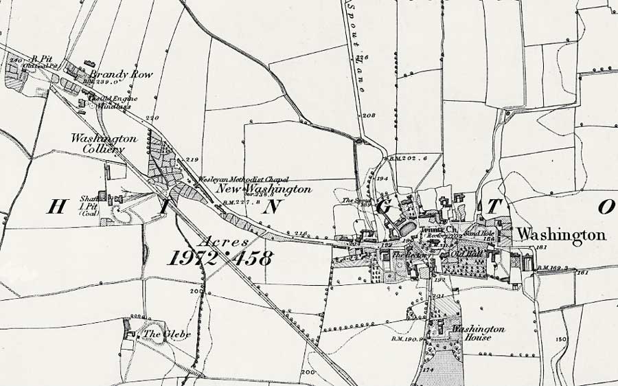
( Thanks to www.nls.uk - National Library of Scotland )
• • ◊ • •
EXTRACT FROM OS MAP 1857
Close-up of The Village and The Spout Discharge Point
NOTE THE SPOUT
( Opposite the Location of the Future Workingmens' Club )
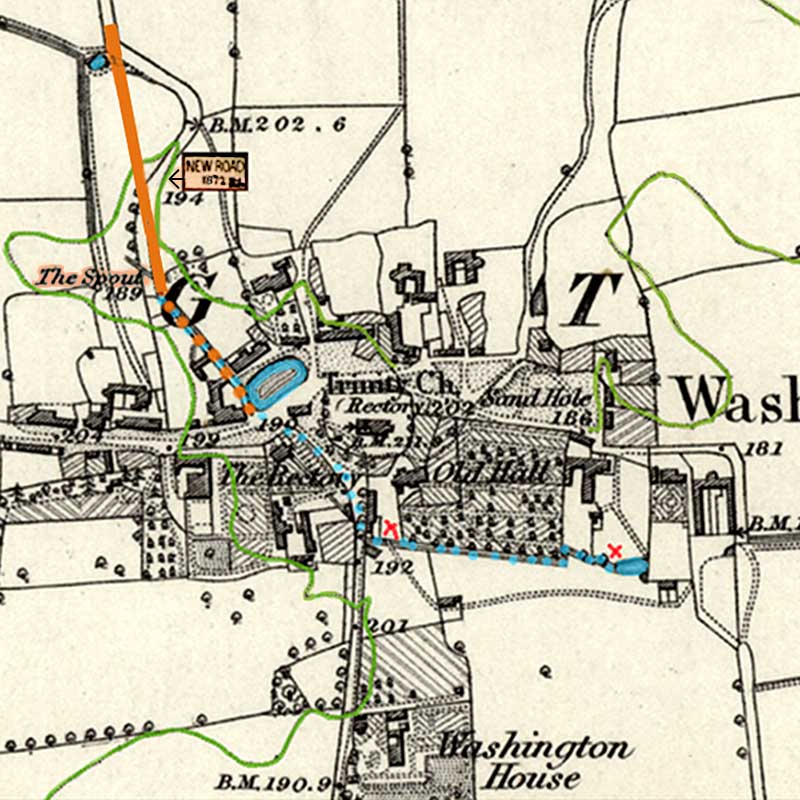
COMMENTS
This is a brief investigation of what I've been told regarding Spout Lane and New Road.
I've marked in green the 200 foot contour line that wraps round the village, where all the heights are lower, apart from
Holy Trinity Church at 211 feet. You'll see 'The Spout' at 189 feet. Marked in blue, the water course runs to the
Village Pond, where the War Memorial now stands. It later turns 90 degrees East passing the Old Hall.
It continued underground, emerging at Barmston Willow Pond. Next, it passed through the
Chemical Works, where it was known as the Dirty Gutter, and finally into R. Wear.
Very old documents refer to a Mill at the Hall. I've marked red Xs as possible sites.
North of The Spout the Lane kinks to the East, and this is what was straightened out in 1872; hence New Road.
The 'Spout Course' passing the Old Hall was much lower than it is today.
The Map tells us that by 1857 the route we see today was in place on built up land.
PLEASE NOTE:
The above comments are not based on solid evidence. They are my personal conclusions
having put together evidence from the 1857 Map and conversations with other interested parties.
[ The Above Map, Highlights & Comments were contributed by Ged Parker, Chair of Washington History Society ]
Can any Visitors help validate, or perhaps modify, Ged's work?
• • ◊ • •
EXTRACT FROM OS MAP 1896
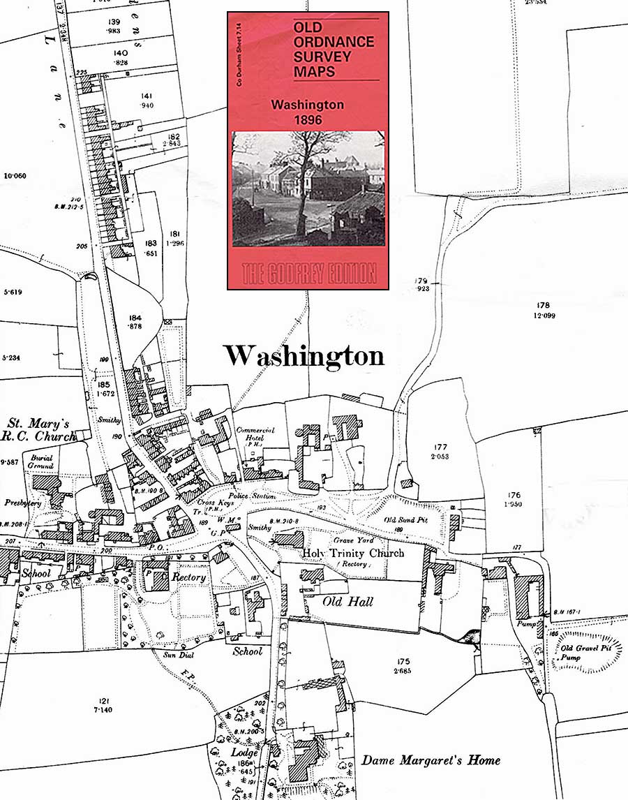
POINTS OF NOTE
The New Road has removed the Kink and the Brook from Spout Lane and left a triangular shaped field.
The Brook is still shown running East from The Avenue, along the bottom of Washington Old Hall, to the small Pond.
• • ◊ • •
1875
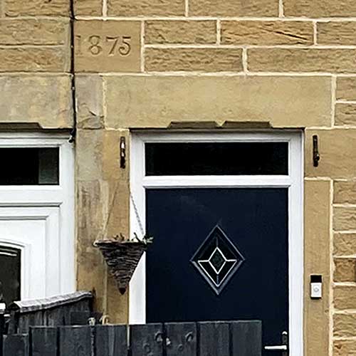
[ Thanks Tom ]
Imagine you're walking down Spout Lane from the former New Inn to Washington Village.
Before you leave the Houses to enter the Pedestrian Tunnel, under the Washington to Sunderland Highway,
look at the front of the last house on your left. It has a Stone with a date carved in it, indicating that it was built in 1875.