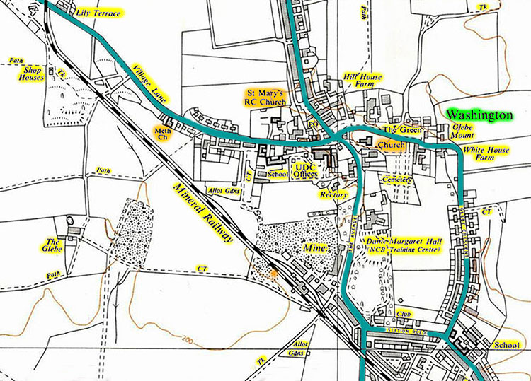
Washington County Durham
HOME WHAT'S WHERE
Memories of Churches & Chapels
In & Around Washington
- High Usworth
- Usworth
- New Washington
- The Village
- Wash Station
- Wash Staiths
- Cox Green
- Fatfield
- Springwell / Eighton
CHURCHES & CHAPELS
High Usworth
Holy Trinity Church
Peareth Hall Road
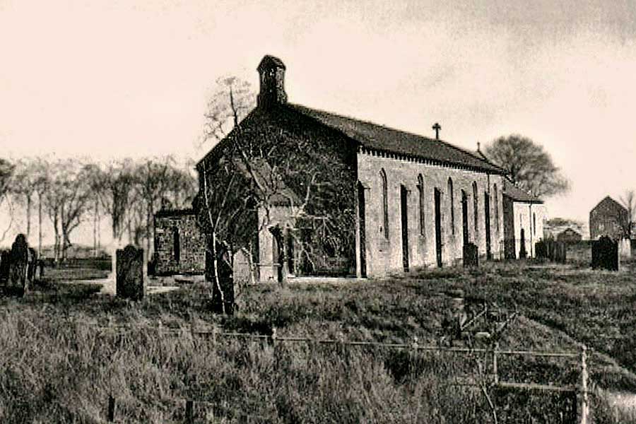
Holy Trinity Church and the Tithe Barn - far right.
Tithes were taxes (one tenth of the annual produce) which were levied to support the local Church & Clergy.
[ A Memorial to Usworth Miners, lost in the 1885 Disaster, can be found close to this viewpoint. ]
• • ◊ • •
Wesleyan Chapel
Well Bank

High Usworth Wesleyan Methodist Chapel, circa 1900.
[ Halfway up Well Bank, opposite The Rectory. ]
• • ◊ • •
1888 Map showing Holy Trinity Church and the Methodist Chapel
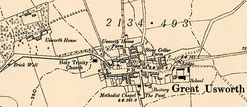
Peareth Hall Road passes Usworth House (later, Peareth Hall), Holy Trinity Church
and the Red Lion pub (PH), on its way east to the top of Well Bank.
CHURCHES & CHAPELS
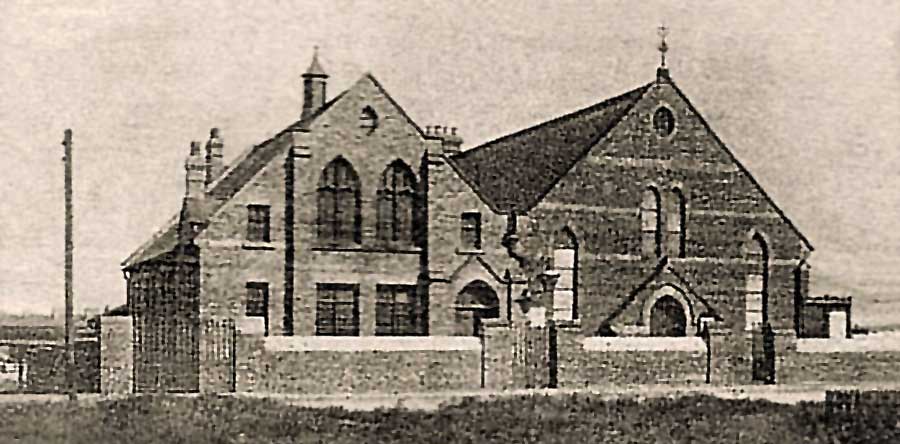
Usworth Colliery
Wesleyan Chapel
Top of Edith Avenue
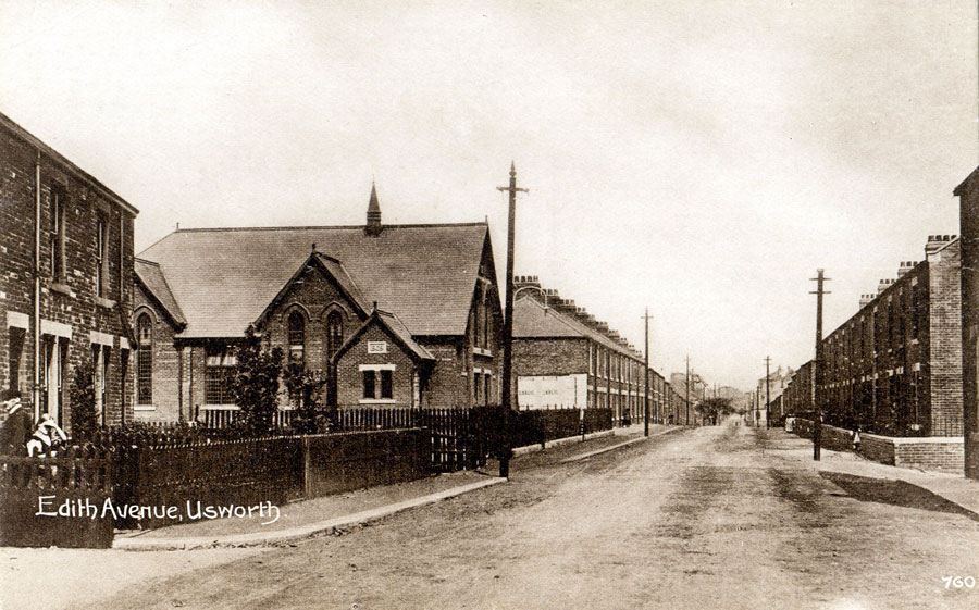
The View from Ralph Richardson's (later Moran's) Shop - at the junction with Usworth Station Road.
[ Looking down Edith Avenue to Waterloo Road. Usworth Colliery on the horizon. ]
• • ◊ • •
Saint Michael & All Angels
Bottom of Edith Avenue
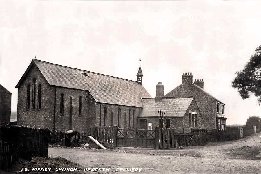
St. Michael & All Angels Church is described as The Mission Church on 1921 Maps.
Situated at the Junction of Edith Avenue, Manor Road and Waterloo Road.
[ Wesleyan Chapel: left, up Edith Ave. Usworth Miners' Hall: straight ahead, along Manor Rd. Primitive Methodist Chapel: right, on Waterloo Rd. ]
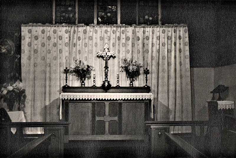
St. Michael & All Angels Church
The Altar
• • ◊ • •
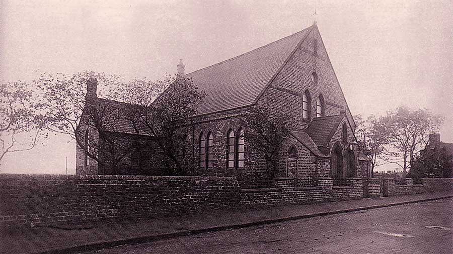
Primitive Methodist Chapel
Waterloo Road
Situated between Usworth Colliery (left) and Manor Road / Edith Avenue (right).
This Chapel was later part of Pawson's Clothing Factory.
[ The 'future' Usworth Green Prefabs were built behind this Chapel - on land between Railway Terrace and Pensher View. ]
• • ◊ • •
Former Methodist Chapel
Waterloo Road
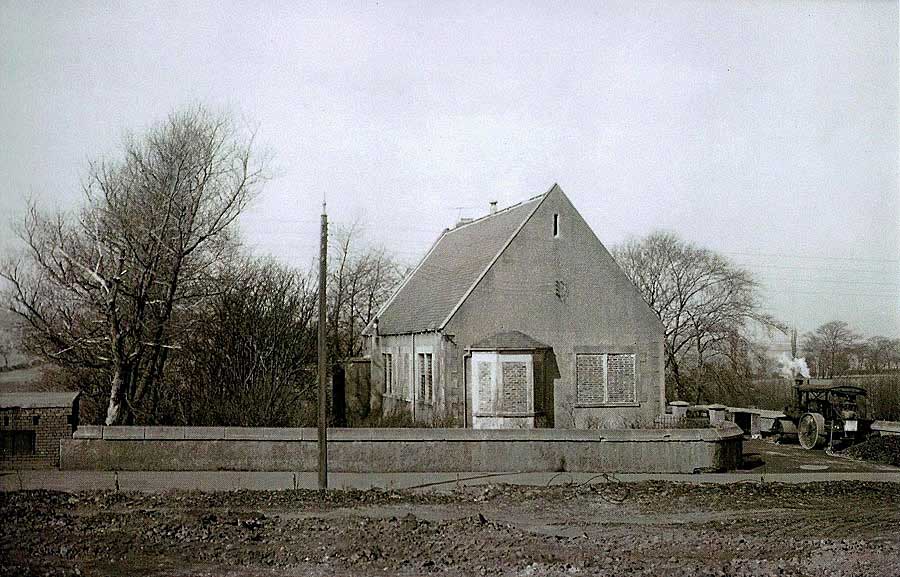
This Methodist Chapel ended its days as Usworth Conservative Club.
[ Situated between Usworth Colliery and Usworth Hall ]
• • ◊ • •
1898 Map showing the Two Methodist Chapels on Waterloo Road
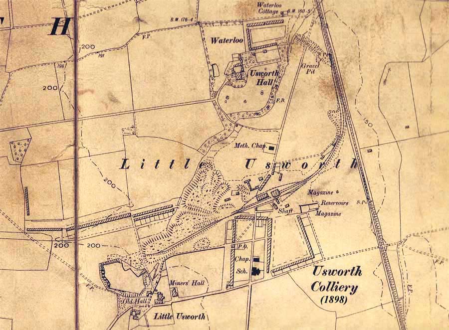
The Primitive Methodist Chapel (Chap.) is just above Usworth Board School (Sch.).
The small Chapel / Conservative Club is labelled (Meth. Chap.)
[ Edith Avenue is bottom-centre. No Saint Michael's yet! ]
CHURCHES & CHAPELS
New Washington
New Rows Chapel
Blue House Lane Corner
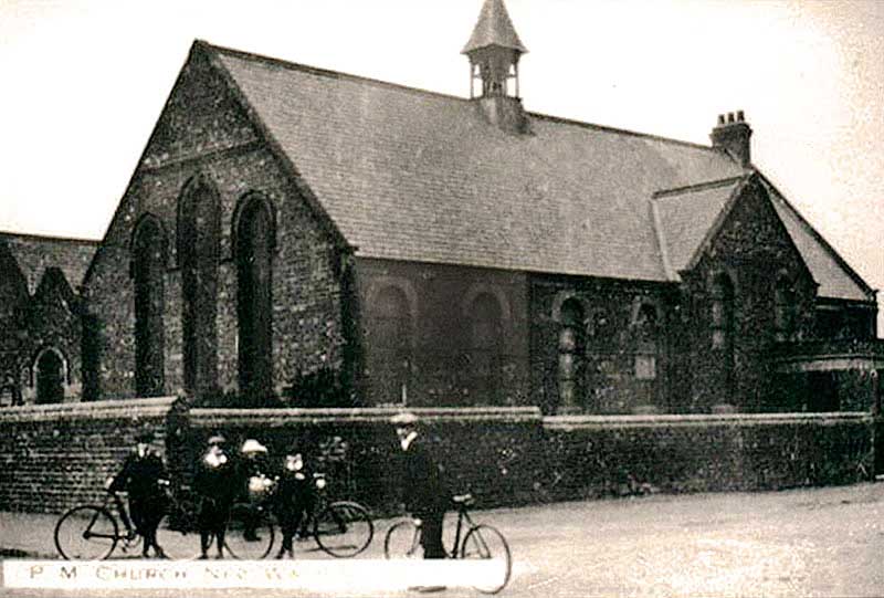
New Rows Primitive Methodist Chapel
Methodist Chapel at the junction of Victoria Road, Blue House Lane (left) and Heworth Road (right)
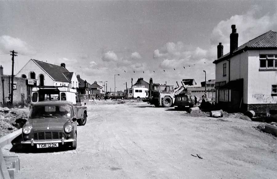
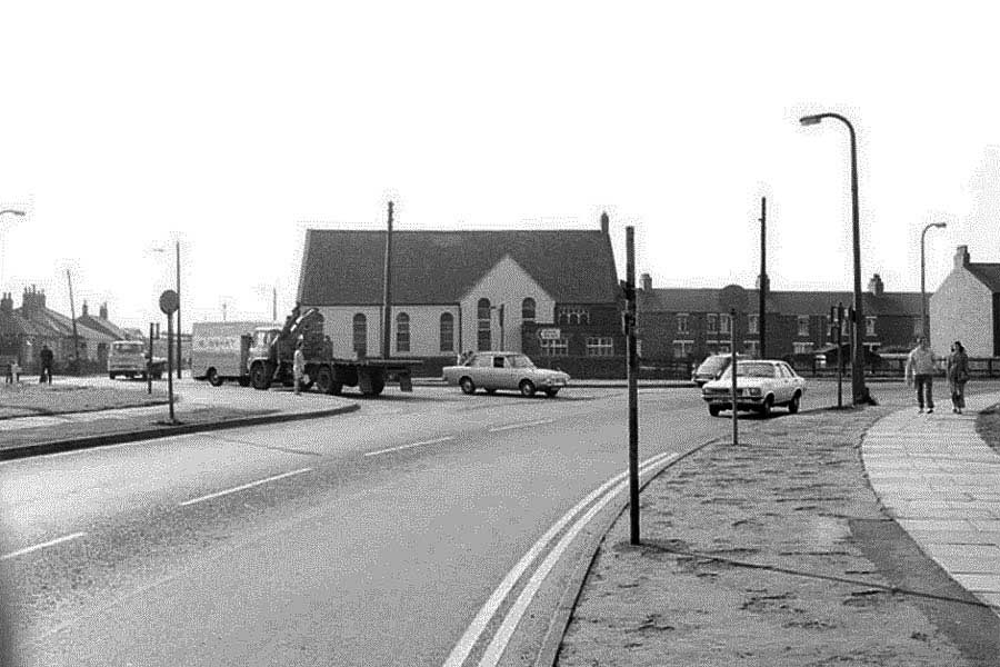
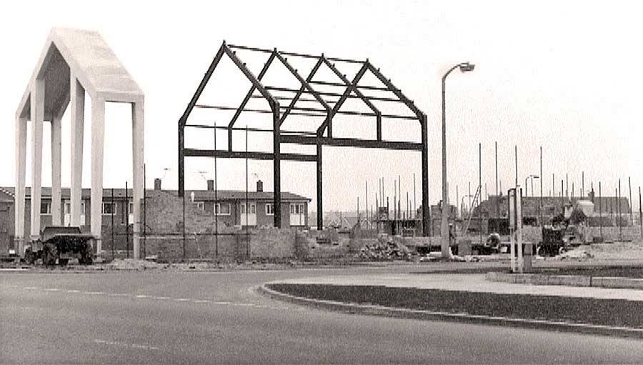
New Rows Methodist Chapel and the Construction of Concord By-Pass Roundabout.
Note the TSB Bank and Dodds' Off-Licence.
[ Washington Development Corporation Archives ]
New Rows Chapel
[ Viewed from the New Inn Corner. ]
• • ◊ • •
Brandy Row Chapel
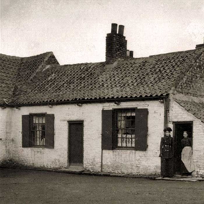
Wesleyan Meeting House at Brandy Row, Washington (built c.1750)
[ Brady Row was situated at the junction of Village Lane and the 'F' Pit Road. ]
• • ◊ • •
Saint Bede's Church
Saint Bede's R.C. Church, on Heworth Road, was built in 1965.
[ Entrance to Coach Road Estate - opposite Douglas Terrace. ]
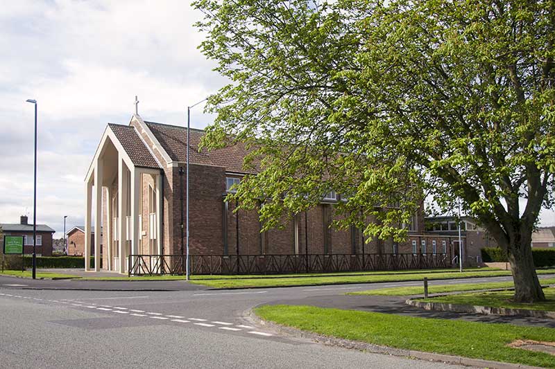
Half a Century Later.
[ Photo: J.G. on Saint George's Day, 2018 ]
CHURCHES & CHAPELS
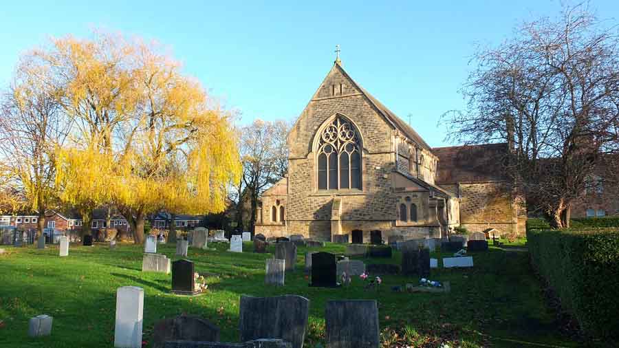
Washington Village
Holy Trinity Church
The Avenue
Holy Trinity Church viewed from The Avenue.
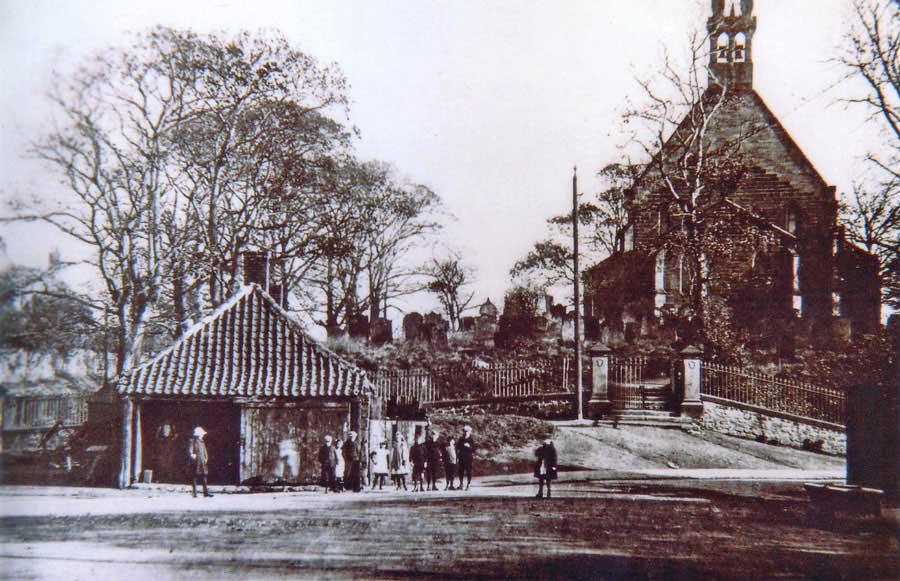
The Smithy and Holy Trinity Church viewed from Village Lane.
[ Spout Lane, left. The Avenue, right. ]
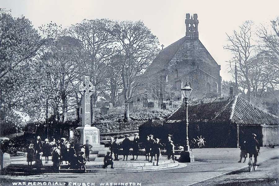
War Memorial / Cenotaph - The Village Smithy - Holy Trinity Church
[ Cyclist leaving Spout Lane. Glebe Crescent, left. The Avenue, straight ahead. ]
• • ◊ • •
Church of Our Blessèd Lady Immaculate
Village Lane
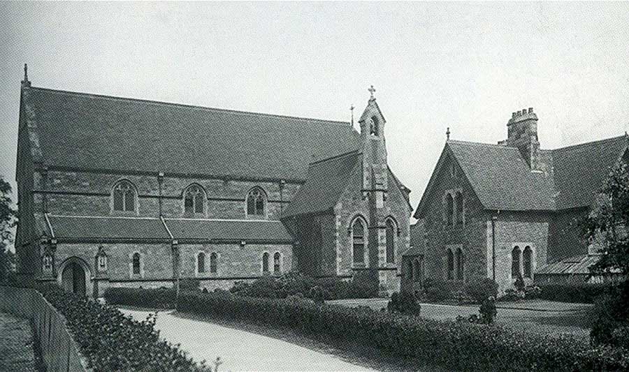
Our Lady's R.C. Church viewed from the main entrance on Village Lane.
[ A Memorial to Usworth Miners, lost in the 1885 Disaster, can be found immediately behind the Church. ]
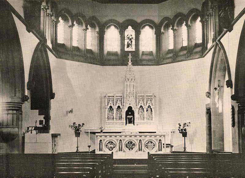
Our Lady's Church
The Altar
Our Lady's Church
( Photographer: Keith Cockerill, 8 December 2025 )
• • ◊ • •
Wesleyan Chapel
Village Lane
The Wesleyan Methodist Chapel on Village Lane
(1877 to 1975)
[ Between Our Lady's Church and Lily Terrace. ]
Also known as the 'Kid Gloves and Lavender Chapel',
its Congregation included many Wealthy Families and Professional People.
[ Info: Thanks to Jim Ferneval ]
• • ◊ • •
Methodist Chapel - Our Lady Immaculate (St Mary's) - Holy Trinity (Church)
Note the 'Washington Wagonway' passing through Glebe Colliery on its way to 'F' Pit from Washington Station.
[ It crossed Fatfield Road just south of today's Glebe Methodist Church. ]
CHURCHES & CHAPELS
Washington Station
Primitive Methodist Chapel
Robinson Terrace / Washington Station Road
Primitive Methodist Chapel at Robinson Terrace (left).
[ Left to St. Cuthbert's Mission. Right to Glebe / J.F.K School. ]
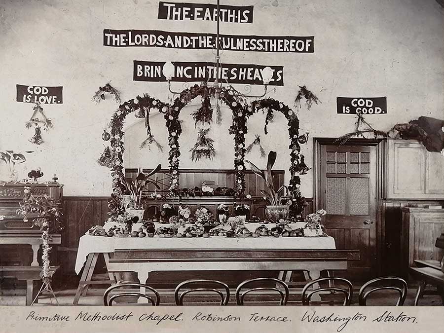
Primitive Methodist Chapel - Harvest Festival
[ Thanks to Washington History Society. ]
• • ◊ • •
Saint Cuthbert's Mission Hall
Washington Station Road
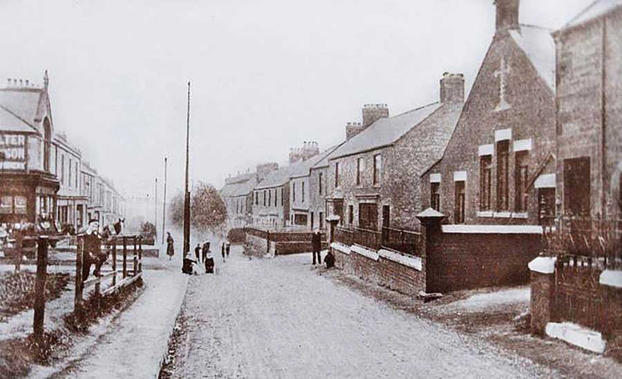
Circa 1900
Walter Willson's & Celtic Club (left). Brady Square (Turn right where the man stands.)
[ Downhill to Washington Station. ]
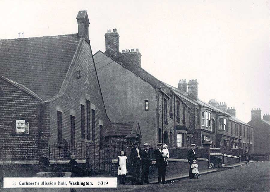
Saint Cuthbert's Mission Hall
[ Uphill to Robinson Terrace Primitive Methodist Chapel. ]
• • ◊ • •
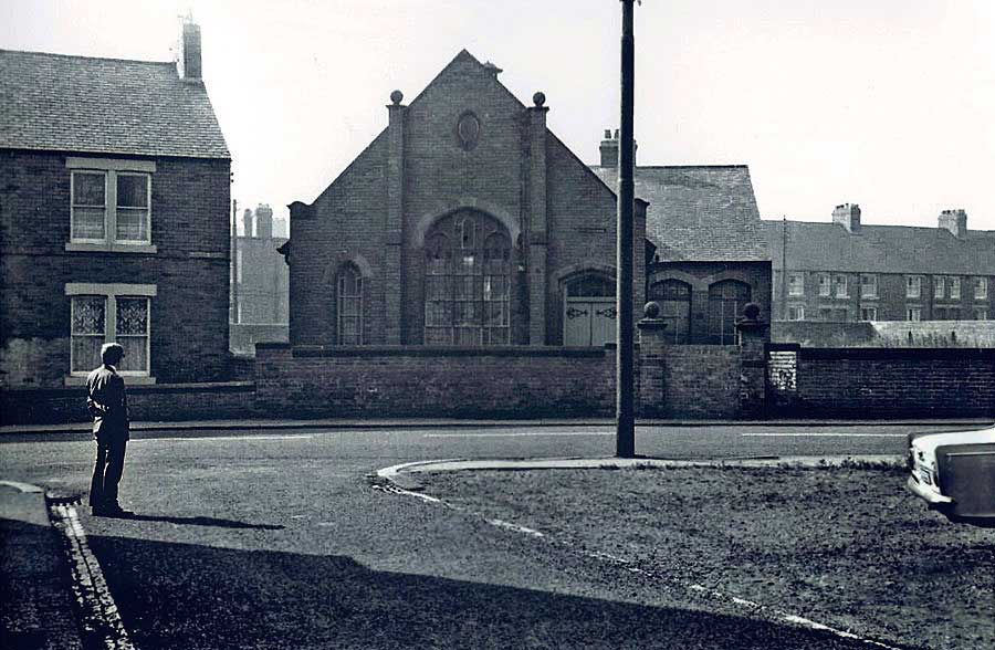
Cook's Methodist Church
( Cook's Chapel )
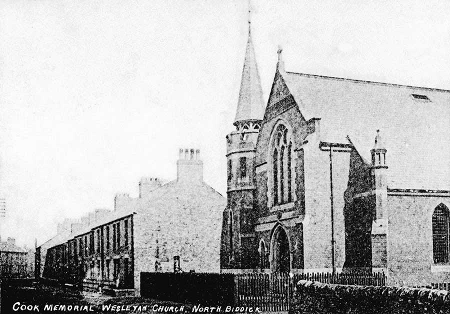
That's Albert Place on the left.
• • ◊ • •
Location of above Chapels
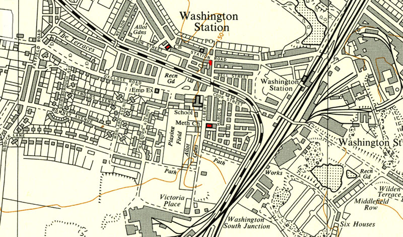
Robinson Terrace Methodist Chapel (Ch) - St. Cuthbert's Mission Hall - Cook's Methodist Church (Meth Ch)
[ Washington Staithes is far right. ]
CHURCHES & CHAPELS
Washington Staiths
Methodist Church
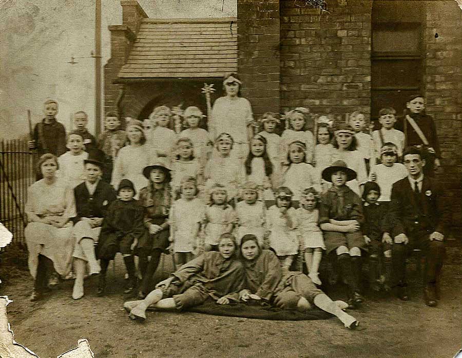
Washington Staiths Church. Bella Reay (née Watson): B/Row, tall. Nancy Forster (née Watson): F/Row, far left.
[ Photograph by Eaton Bros, New Washington. ]
• • ◊ • •
Location of Washington Staiths Methodist Church
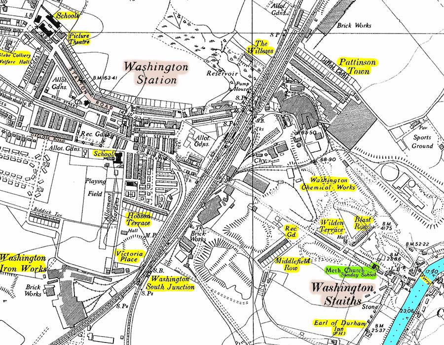
Map: Circa 1950
• • ◊ • •
Another Chapel at Washington Staiths?
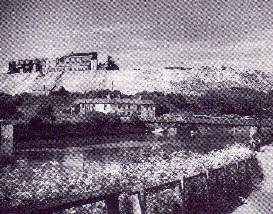
I've been advised that the building below the Chemical Works Spoil Heap was also a Chapel. Sadly, no details.
[ The Footbridge replaced the Ferry in May 1958. ]
CHURCHES & CHAPELS
Cox Green
Wesleyan Methodist Chapel
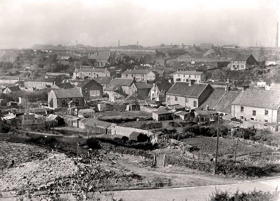
The small Methodist Chapel is situated left of centre.
Seen across the road leading down from Cox Green Station to the Oddfellows Arms on the south bank of the River Wear.
[ Thanks to Keith Cockerill. ]
There's a wealth of Local History shown in this wonderful 1937 Photograph. See what you can identify.
• • ◊ • •
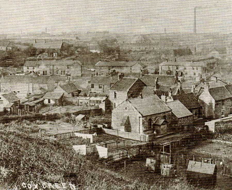
Earlier Close-up of Cox Green Chapel
• • ◊ • •
OS Map c.1937-61
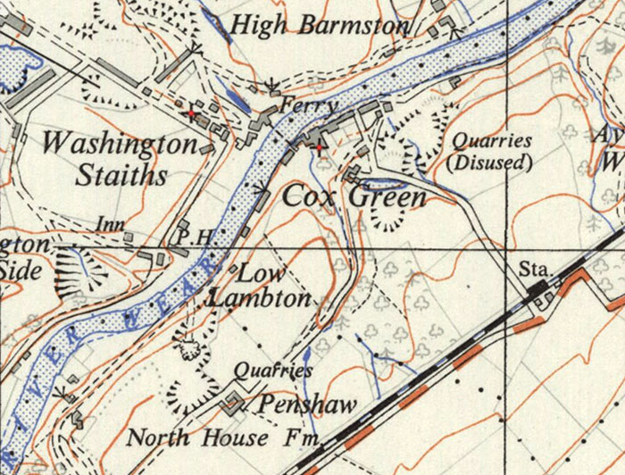
Methodist Church at Washington Staiths (left Cross). Methodist Chapel at Cox Green (right Cross).
CHURCHES & CHAPELS
Fatfield
Saint George's Church
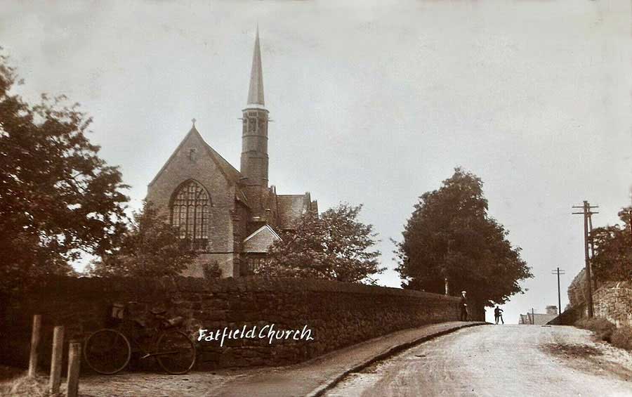
Viewed from Vigo Lane
[ Is that the Photographer's Bike parked against the Wall? ]
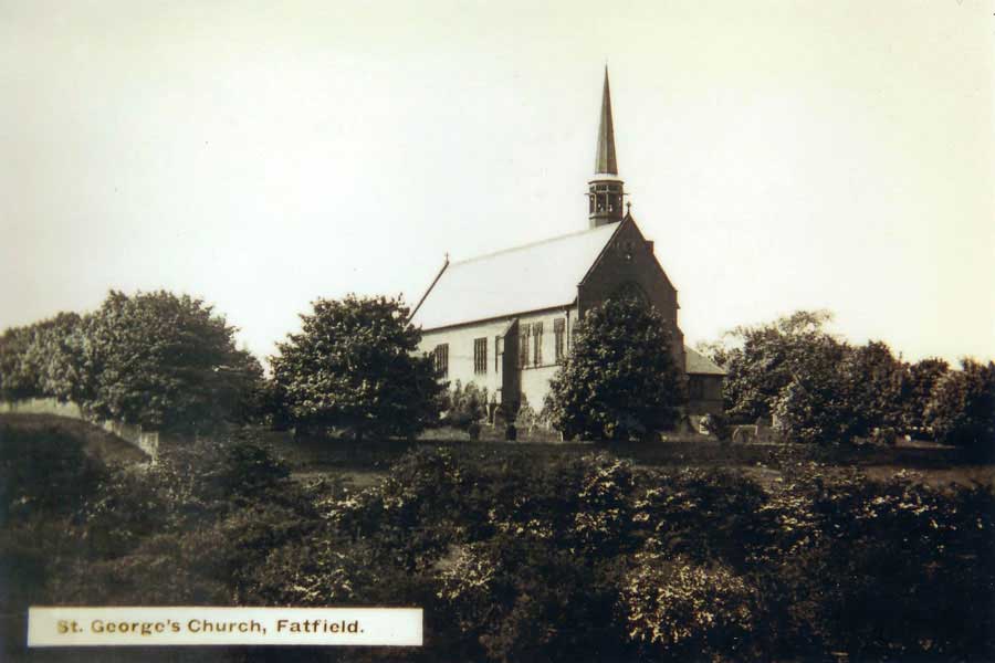
Viewed from Bonemill Lane
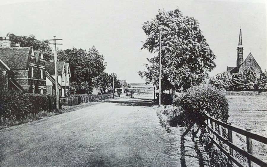
Vigo Lane and Saint George's Church, c.1950
[ Looking towards Penshaw and the junction with Bonemill Lane. ]
• • ◊ • •
Primitive Methodist Church
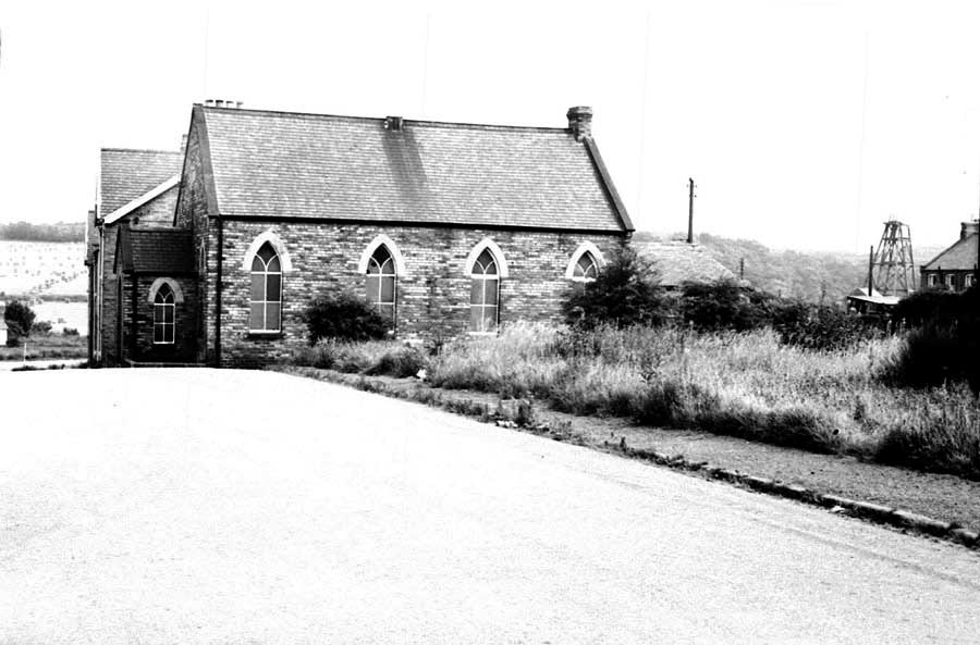
Primitive Methodist Church & Chartershaugh Colliery Headgear.
Map c.1939
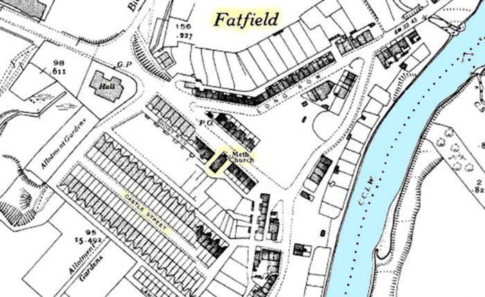
Primitive Methodist Church at Chartershaugh
[ Note: Castle Street, Harraton Miners' Hall & Biddick Lane. ]
CHURCHES & CHAPELS
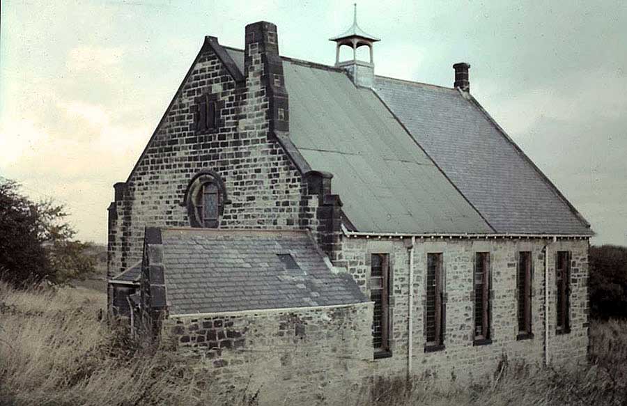
Springwell
Wesleyan Methodist Church
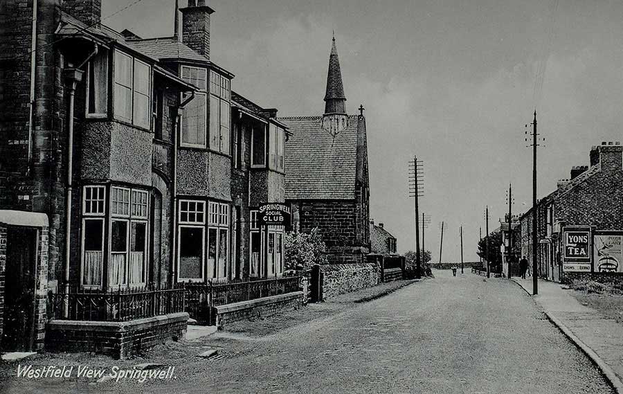
Springwell Club & Methodist Church. Left down Stoney Lane; right to Mill House.
[ Picture from Keith Cockerill's Postcard Collection. ]
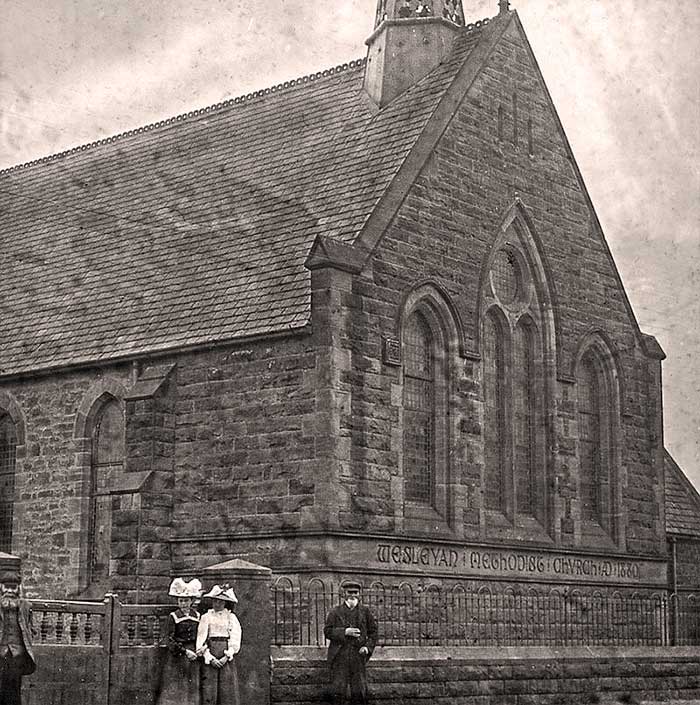
Springwell Wesleyan Methodist Church AD 1880.
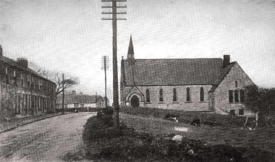
Springwell Methodist Church. That's Coronation Terrace on the left.
[ Looking in the direction of The Guide Post Inn. ]
• • ◊ • •
Eighton Banks
Wesleyan Methodist Chapel
18th Century Methodist Chapel.
Location: Junction of Galloping Green Road and Thomas Street, near The Waggon Inn (off-picture, left).
[ Now The Mount Community Association. ]