Washington County Durham
HOME WHAT'S WHERE THEN & NOW PAGE 5/8 PAGE 7/8
Memories of Washington
Then & Now Collection ( 6/8 )
Usworth Station
Looking north: The Leamside Line passes Usworth Colliery (left, ½m) and Follingsby (Wardley No.1) Colliery (right, 2m).
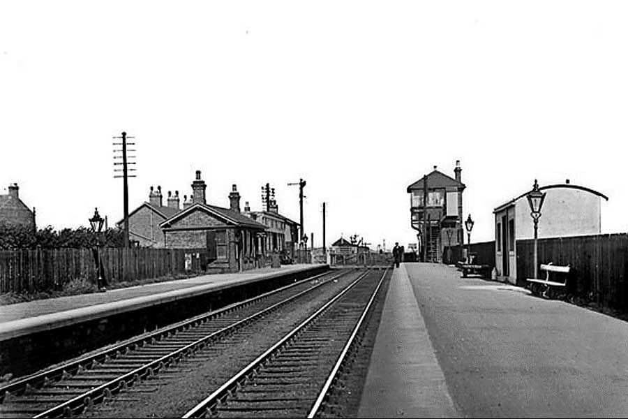
THEN
Note level crossing on the 'New Washington / Sunderland' road. There's a hint of an Usworth Colliery pit heap in the distance.
[ Photo: H.G.W. Household ]
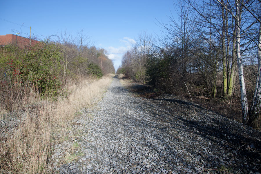
NOW
The level crossing has gone but the 'Concord - Sunderland' minor road is just visible.
[ Photo: J.G. 28th Feb 2017 ]
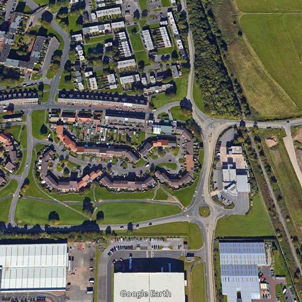
NOW 2
Aerial View of the former Usworth Station, centre-right to bottom-right.
[ Google Earth: 4th Feb 2015 ]
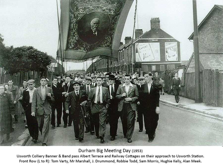
THEN
Who remembers joining the crowds at Usworth Station for 'The Big Meeting' at Durham or the 'Top Club Trip' to South Shields?
[ The Top Club provided members' children with 'half a crown' each to spend. Wow! The house gable ends in this picture can also be seen in the top picture. ]
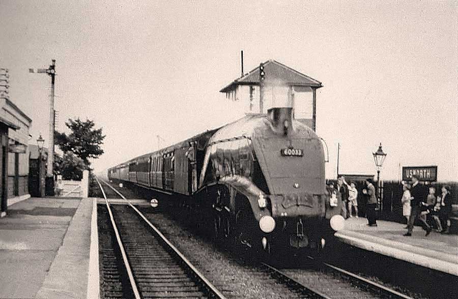
THEN
Class A4 locomotive No.60033, Seagull - heading south towards Durham.
( Note the trainspotters - probably a Sunday in the late 50s / early 60s. )
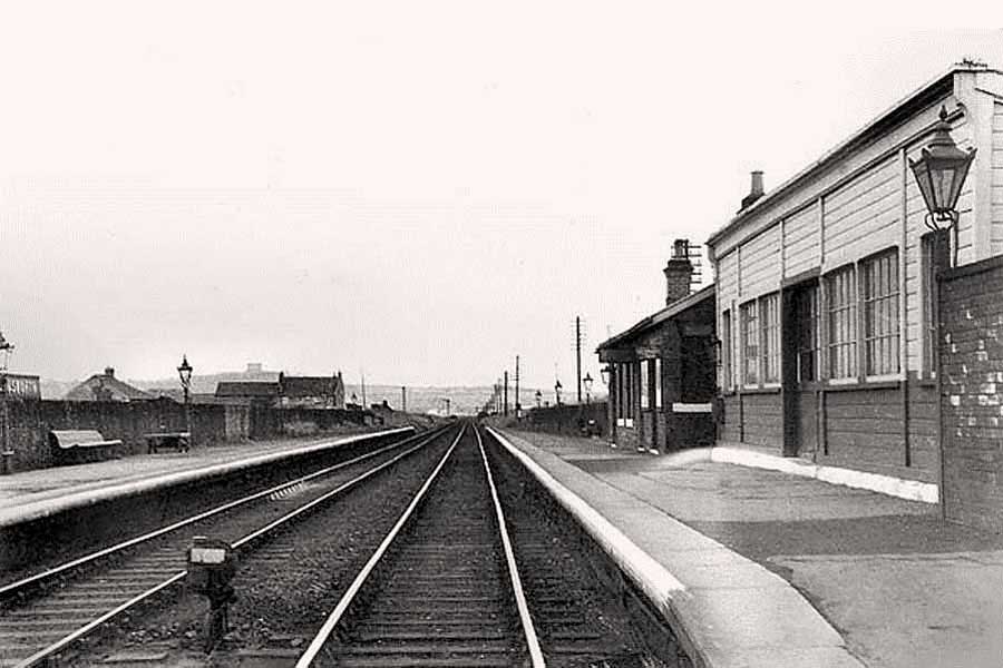
THEN
The view south towards Washington Station, 1½ miles away.
( Note Penshaw Monument on the horizon. )
Marble Arch
On the Leamside Line between Usworth and Washington Stations
[ Sorry, I don't have an old photograph of the Arch itself. ]
THEN
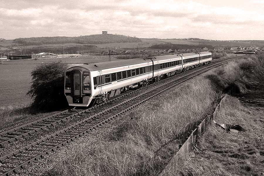
Having passed through Usworth Station (left) this Diesel Multiple Unit is heading towards Washington Station (right).
Note the relative positions of Penshaw Monument, the tiny white Cox Green Station, and the Train.
Conclusion: This Train is passing Barmston Village in the vicinity of Marble Arch.
[ View from Sunderland Highway embankment. Photographer & Date: unknown ]
NOW
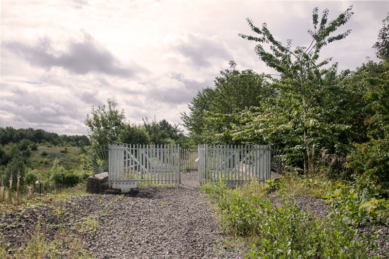
Marble Arch - The Approach from Glebe Crescent via Barmston Village
[ Photo: J.G. 17th Aug 2018 ]
NOW
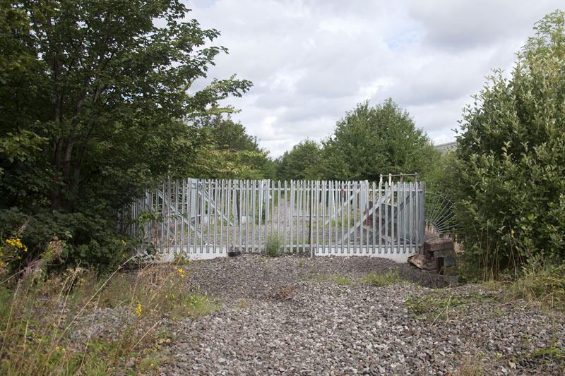
Marble Arch - The Approach from Middle Barmston Farm via Pattinson Industrial Estate (North)
[ Photo: J.G. 17th Aug 2018 ]
NOW
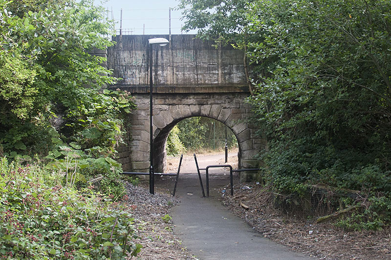
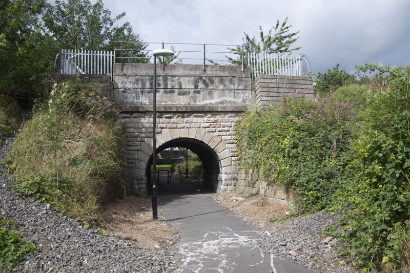
Marble Arch - The Approach from Usworth Station
[ Photo: J.G. 17th Aug 2018 ]
NOW
Marble Arch - The Approach from Washington Station
[ Photo: J.G. 17th Aug 2018 ]
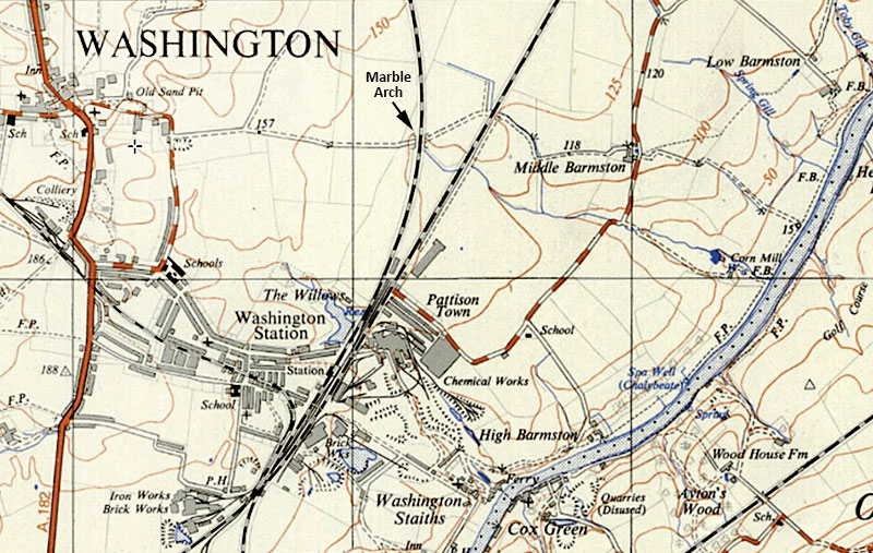
THEN
Marble Arch - top, centre
[ OS Map 1937-61 ]
A WALK THROUGH FARM LAND & COUNTRYSIDE
Glebe Crescent to the River Wear: passing under the Leamside Line at Marble Arch; over the 'Tyne Dock to Consett' Line;
through Middle Barmston Farm yard; down the country road; along the stream to the area known as 'The Forge'.
Me 'n' me marras, Bunse & Stubba, would return along the banks of the River Wear to Cox Green; we'd pass Wilden Terrace;
cross the Long Footbridge at Washington Station (stopping for a bit of Trainspotting);
and then catch the 25 or 80 at Brady Square Bus Station.
Fare to New Washington (Concord): 1d.
If we were feeling fit, we'd 'Run two lamp posts and Walk one'. That got us to the New Inn Corner in no time at all!
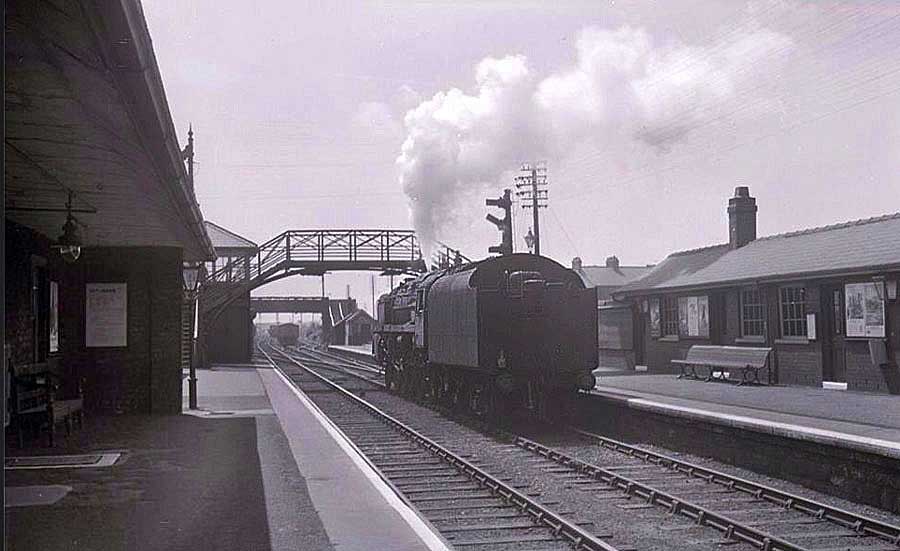
Washington Station
Looking north-east: The Leamside Line continues to Pelaw Junction via Usworth Station, 1½ miles away.
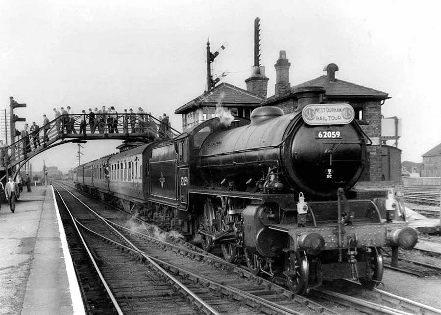
THEN
An excursion train to West Durham, hauled by K1 Class Locomotive 62059, calling at Washington Station.
[ The 'Tyne Dock to Consett' line can be seen on the right of this photograph. ]
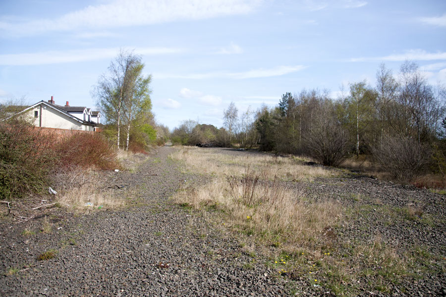
NOW 1
Note the shadow in the distance - that's approximately where the former Leamside Line crossed Washington Station Road.
[ Photo: J.G. 5th April 2017 - taken from the path, bottom-right, in the aerial picture below. ]
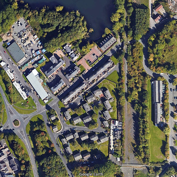
NOW 2
Aerial View of the former Washington Station
The fenced path, bottom-right, is a few metres north of the demolished long footbridge.
[ North-East at the top. Google Earth: 4th Feb 2015 ]
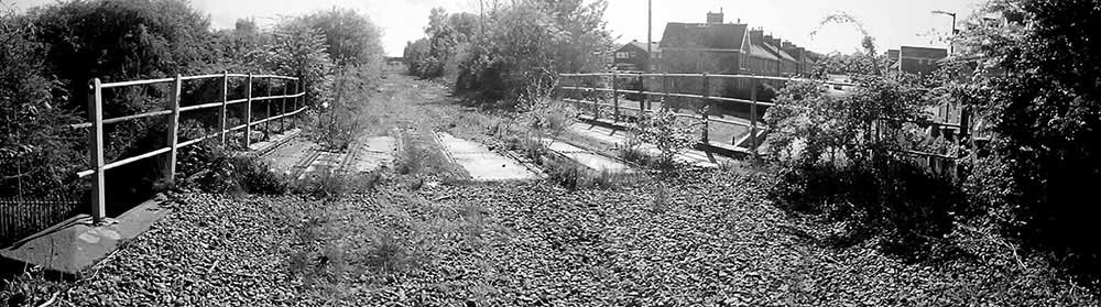
Between THEN & NOW
The Bridge over Washington Station Road - not too long ago!
[ Note the long footbridge in the distance. Photographer: unknown. ]
THEN
Washington Station: looking south-west towards Washington Junction, Victoria Viaduct, Penshaw Station & London.
[ The 'Now 1' photograph was taken from the path that replaced the long footbridge. ]
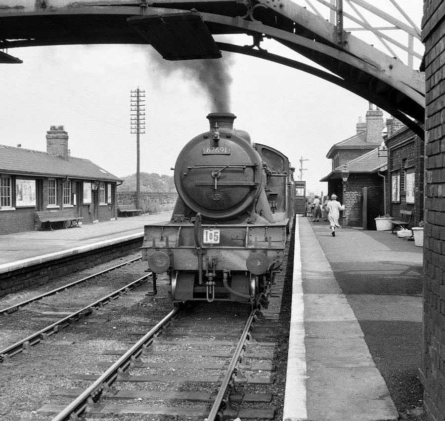
THEN
Southbound train calling at Washington Station.
( 19th July 1958 )
THEN
View from the long footbridge that once straddled all the railway lines.
( Leamside Line, left; Tyne Dock - Consett line, right. )
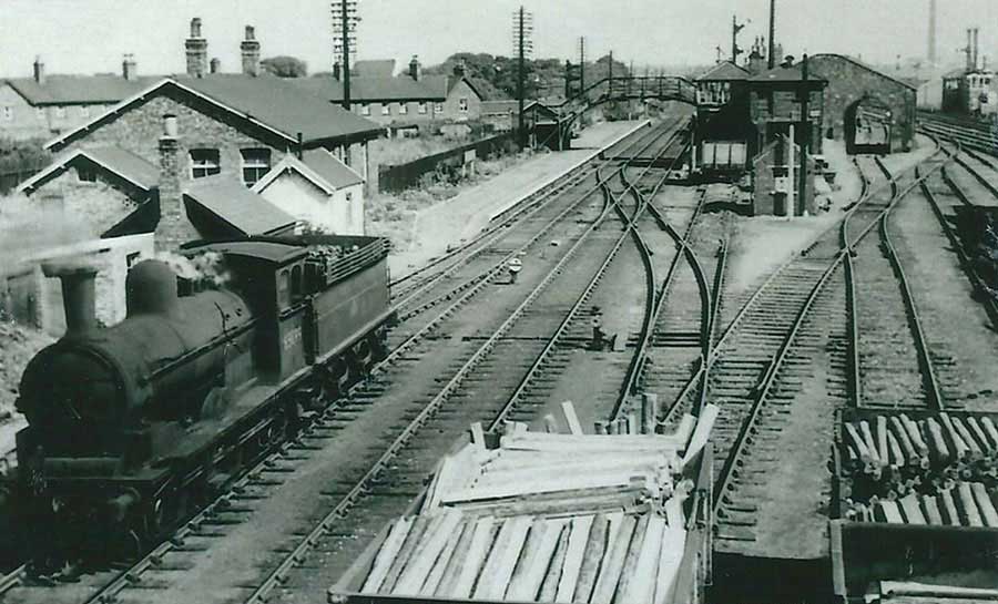
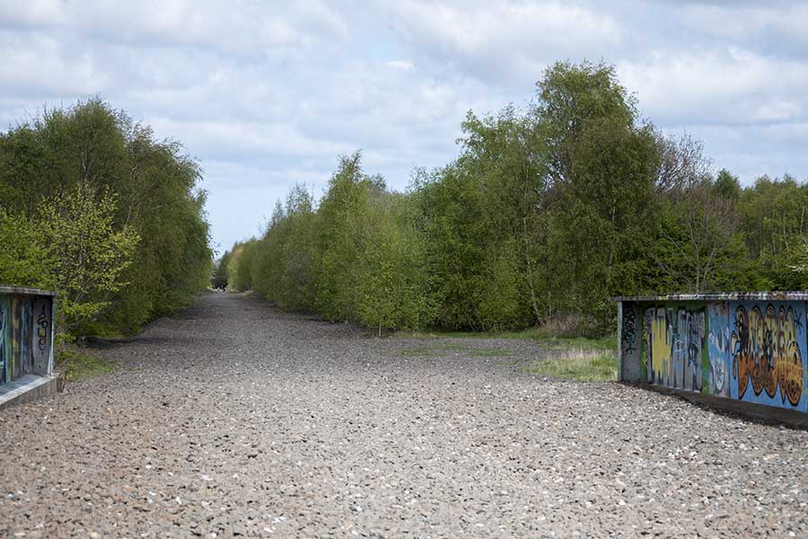
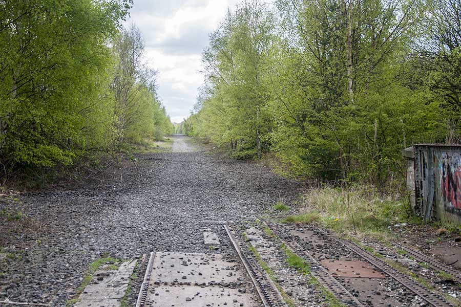
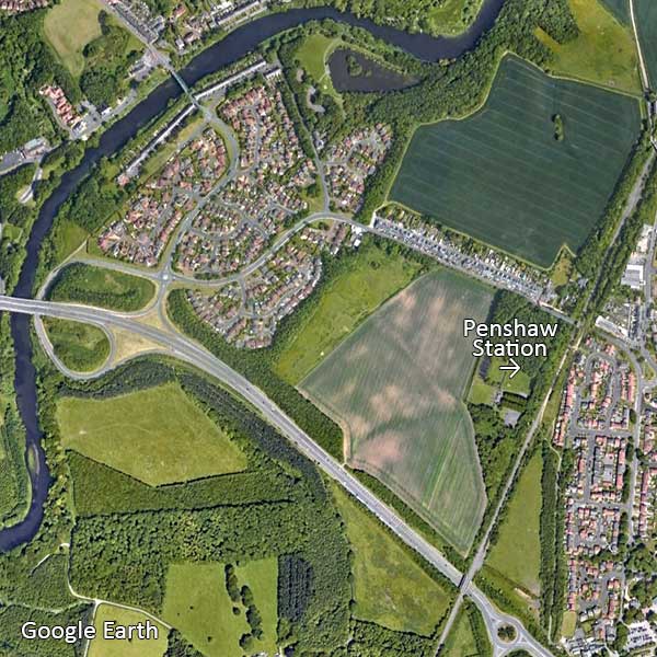
Penshaw Station
Looking north-east: The Leamside Line continues to Washington Station, via Penshaw Junction & Victoria Viaduct.
THEN
The platforms were accessed via steps under the Penshaw Station Road, Railway Bridge - just beyond the station buildings.
[ Photographer: John Mann, 22nd September 1924 ]
NOW 1
The view looking north-east towards the former Penshaw Station, which was close to those distant walkers.
[ Photo: J.G. 20th April 2017 - Bridge over the A182 Washington Highway. ]
NOW 2
The view looking south-west - the site where Penshaw Station once stood.
[ Photo: J.G. 20th April 2017 - Bridge over Penshaw Station Road. ]
NOW 3
Aerial view of the former Penshaw Station
Note the bridges where the Leamside Line crossed the Washington Highway & Penshaw Station Road
[ Google Earth: 4th Feb 2015 ]
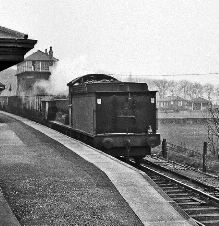
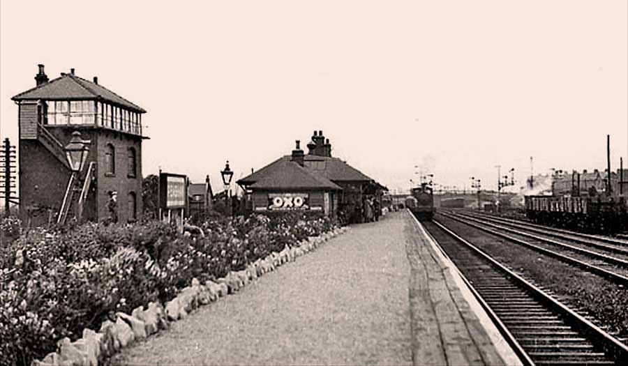
THEN
Penshaw Station. Note Penshaw 'Rec'.
( 1964 )
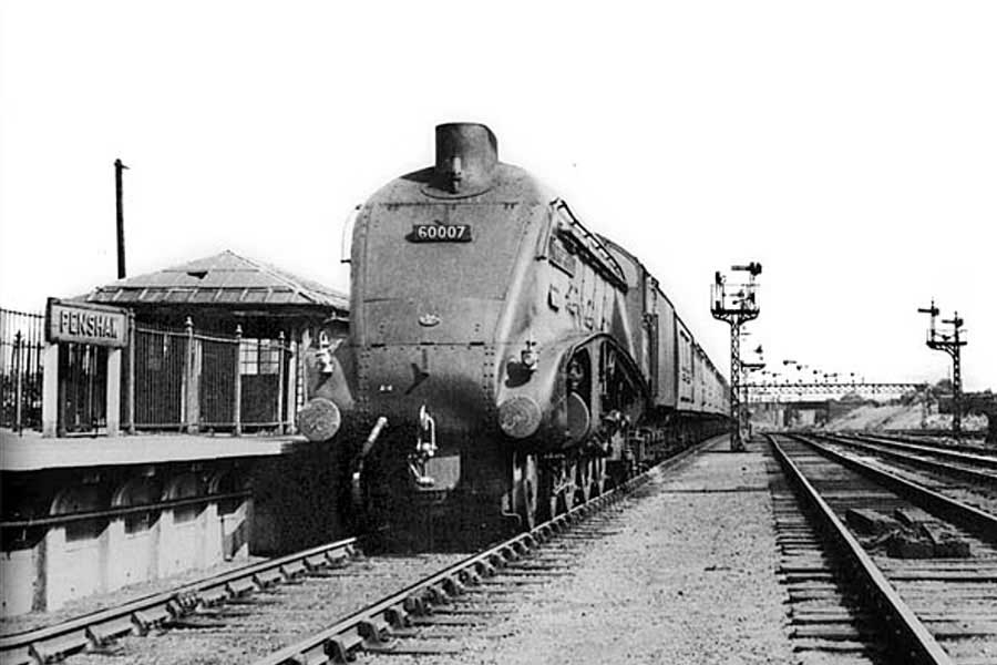
THEN
Bound for London: Class A4 Pacific No.60007, Sir Nigel Gresley.
(Photographer: Ian S. Carr - Sunday, 23rd August 1959)
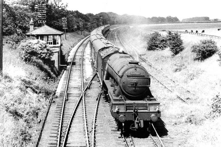
THEN
The view from Wapping Bridge, near 'Lambton Lion Park'. A3 No.60042 leaving the 4-track section from Penshaw Station.
[ Photographer: unknown - 18th June 1961. ]
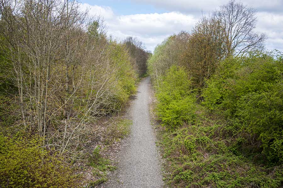
NOW 4
The view looking north towards the former Penshaw Station, exactly 1 mile away. Note the curve to the right (north-east).
[ Photo: J.G. 20th April 2017 - Wapping Bridge, Bournmoor. ]
View From Penshaw Hill
... looking North.
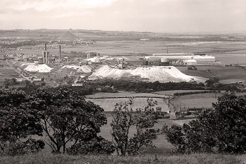
THEN
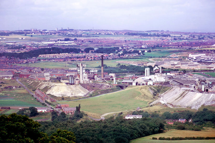
Cox Green Station, Road down to River Wear, Washington Chemical Works, Empty Fields & Washington 'F' Pit Heap
[ The River Wear, hidden in the trees, runs horizontally, mid-picture. ]
BETWEEN THEN & NOW
Washington Chemical Works viewed from Penshaw Hill.
[ Photographed & Contributed by Dr Stafford Linsley. Picture: August 1971 ]
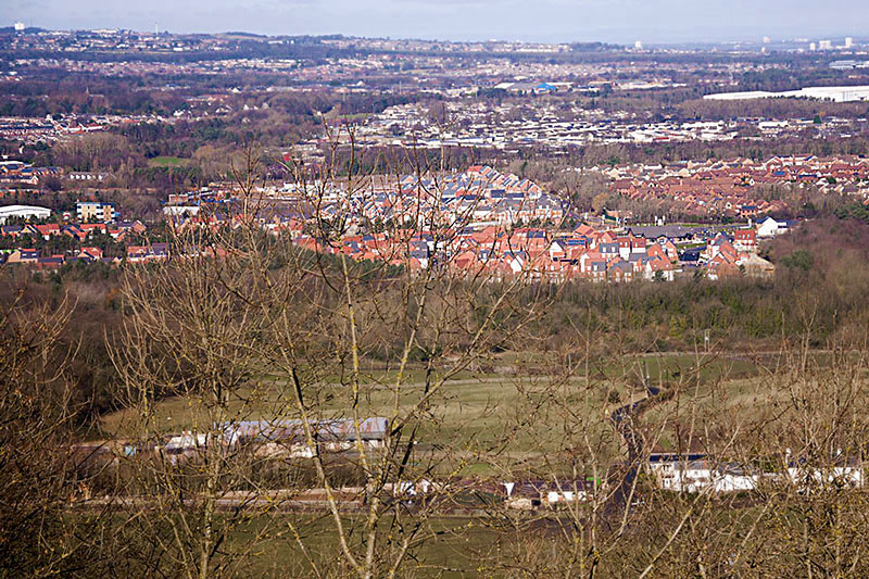
NOW
Note the road leading from the former Cox Green Station, down to Cox Green Village & River Wear.
[ Photo: J.G. 7th March 2017 ]
• • ◊ • •
WHAT'S IN A NAME?
"That which we call a rose by any other name would smell as sweet."
( Juliet )
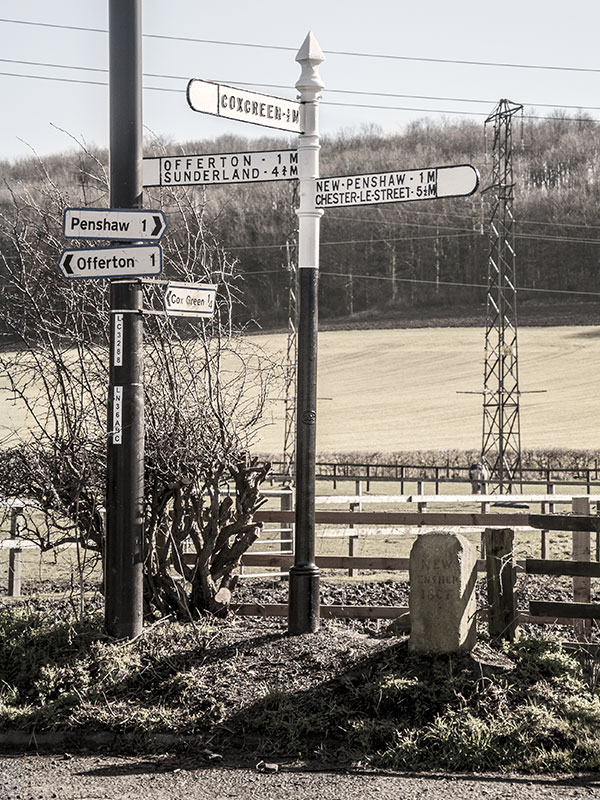
NOW
Temporary, 'Old but Refurbished' & Very Old: Road Signs at former Cox Green Station.
The Old Sign reads Coxgreen, not the modern name of Cox Green.
Maps; River Wear (1737) describes it as Cock's Green.
[ Photo: J.G. 7th March 2017 ]
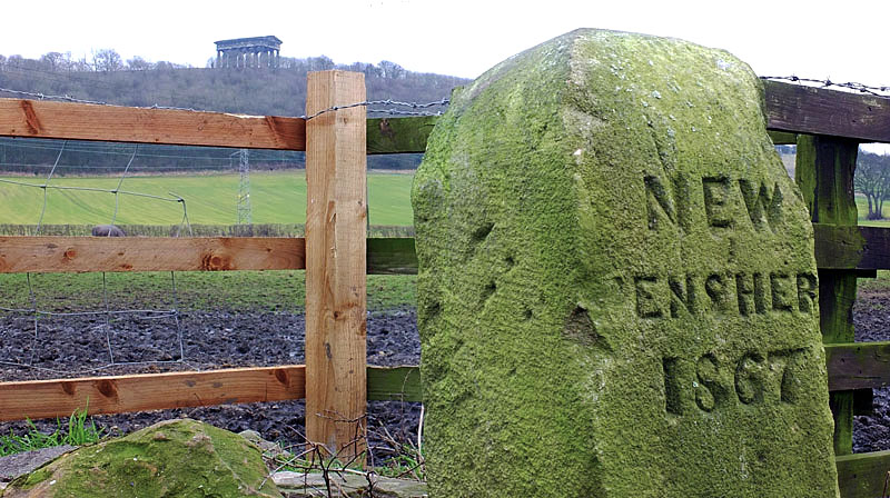
NOW & THEN
Pensher View (Terrace in Usworth), New Painshaw & Painshaw Station (Maps: Washington, 1888-1913), New Penshaw (Current Name).
[ Photographed & Contributed by Keith Cockerill, 3rd March 2017 ]