Washington County Durham
HOME WHAT'S WHERE THEN & NOW PAGE 7/8 PAGE 1/8
Memories of Washington
Then & Now Collection ( 8/8 )
- Galleries Bus Station 1/4
- 2/4
- 3/4
- 4/4
- Eighton Banks / Sheddon's Hill
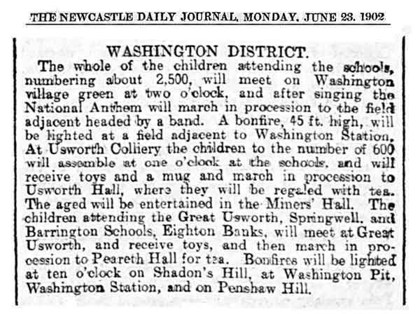
- Schoolkids' Coronation Celebrations - 1902
- Mill House
Washington Galleries Bus Station
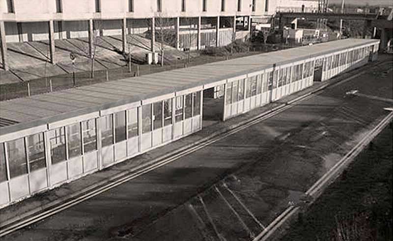
THEN
The Cold & Draughty Bus Shelter
Woolco: top-right
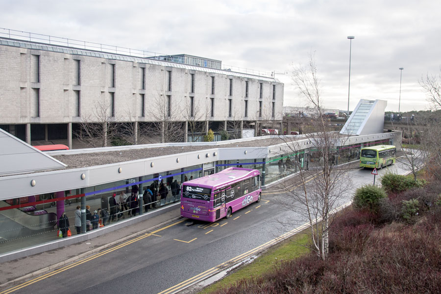
NOW
View from the overhead walkway near Durham House
Escalator up: left. Steps up: right.
[ Photo: J.G. 27th December 2017 ]
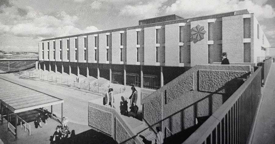
THEN
The original concrete steps, from The Galleries main entrance and Woolco Superstore, to the Bus Station & car parks
THEN
Steps down to The Galleries Bus Station. Woolco Superstore
Washington Galleries Bus Station
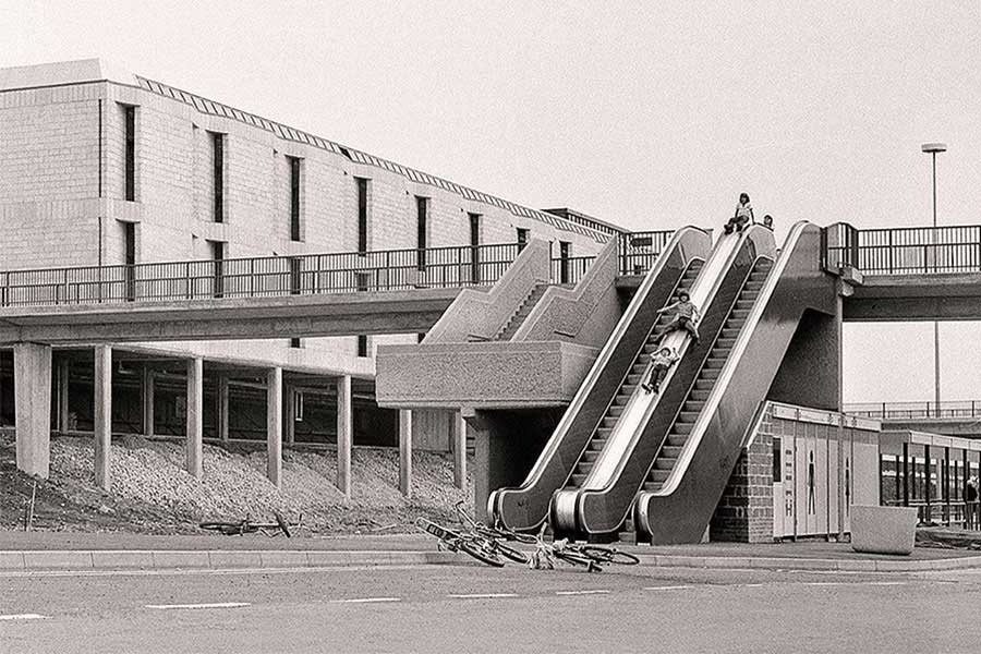
THEN
Kids will be Kids!
The Original Escalators at the north end of the Galleries Bus Station.
[ Does anyone know who the Kids are, or who took this superb photograph? ]
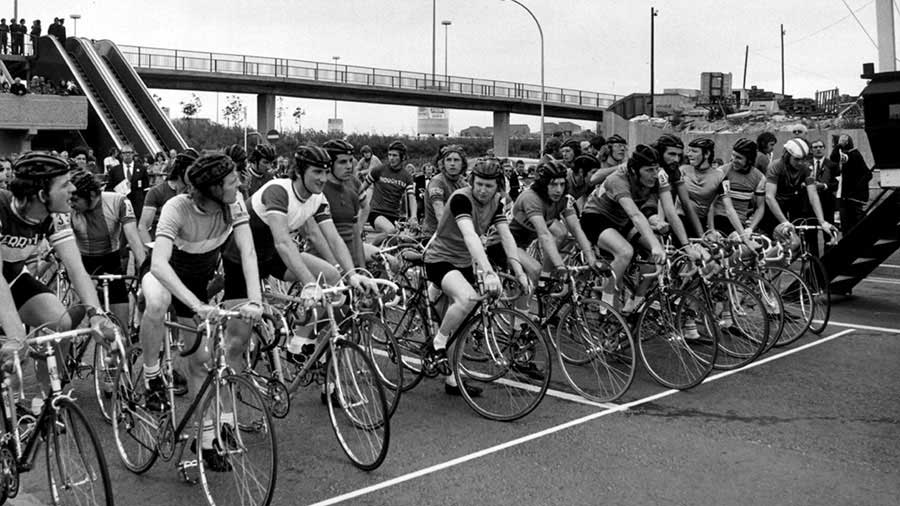
THEN
Major Cycle Race
The Bus Station is behind the escalators and the cyclists are facing north.
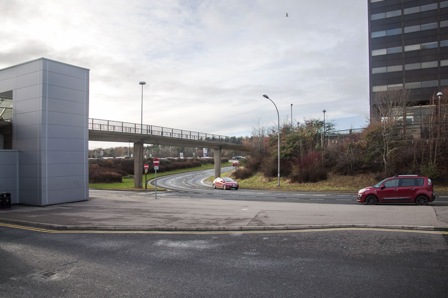
NOW
Compare the walkway pillars, the pattern of the fencing, the curved street lamp and the 'no-entry' sign.
The outdoor escalator has been removed and its replacement is on the other side
of the walkway, where it leads directly into the new Bus Station.
[ Photo: J.G. 27th December 2017 ]
Site of Washington Galleries Bus Station
( Alongside the large building, bottom-left )
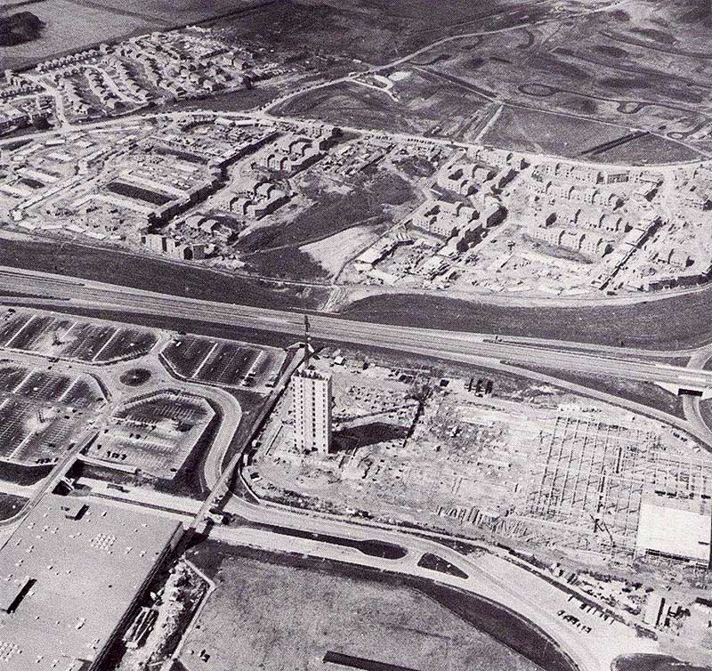
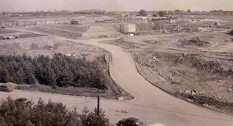
THEN
Oxclose Village (under construction), Washington Highway, Car Parks, Durham House and Washington Galleries Bus Station.
On the Durham House side, the Outside Escalator and Concrete Steps lead down and away from the Bus Station.
From the road/walkway on the Woolco side, the Concrete Steps lead down into the Bus Station.
South Approach To Washington Galleries Bus Station
THEN
Left to Car Parks. Ahead to Bus Station. Right to Washington Highway, Oxclose and Lambton.
[ Traffic lights here now. ]
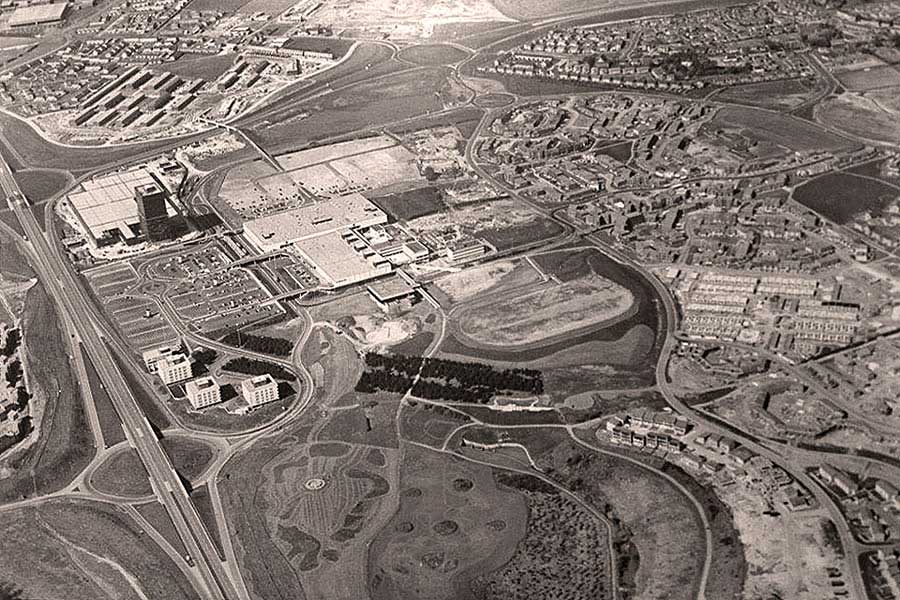
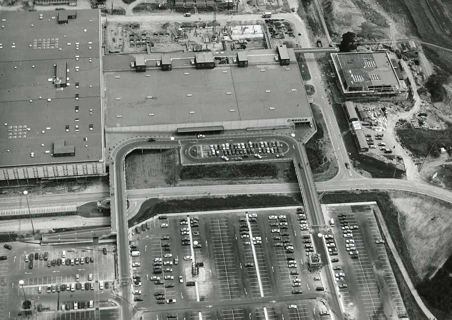
SOME YEARS LATER
Aerial View showing The Galleries and its Bus Station
[ Note the road junction shown in the top image. ]
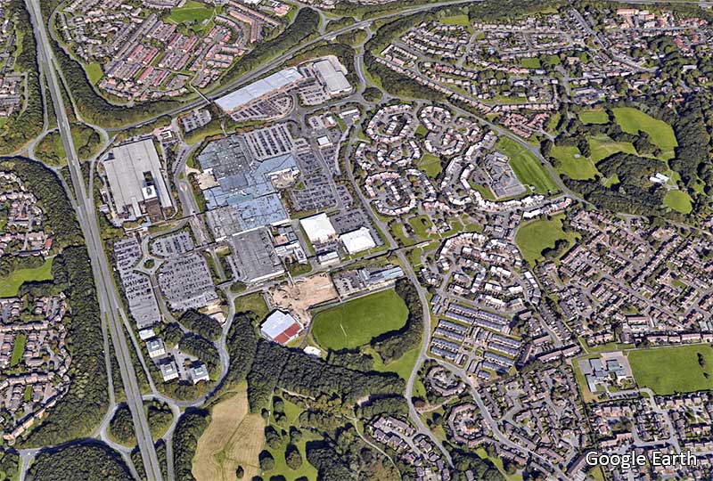
NOW
Google Earth
[ 2018 ]
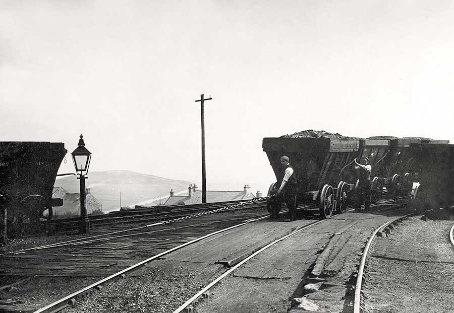
Eighton Banks Railway Crossing
Looking North from Sheddon's Hill.
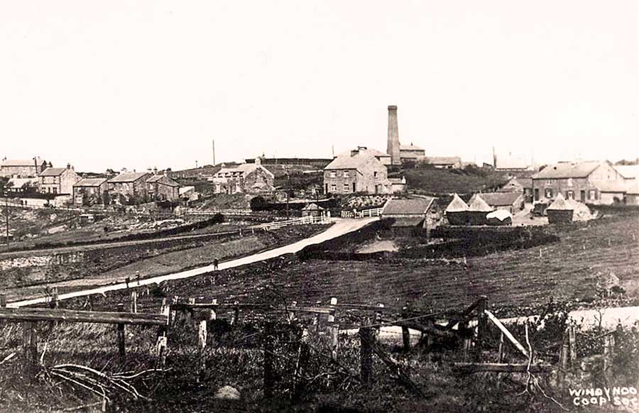
THEN
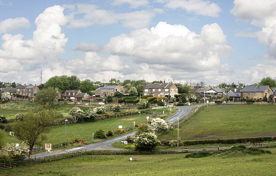
Eighton Banks as seen from the lower, north side of Sheddon's Hill. Bowes Railway Level Crossing, centre-picture.
The square section chimney is that of the Ouston / Pelaw Main, Eighton Banks Engine. Blackim Hill Engine is further right.
Mount Moor Colliery is off-picture, left.
[ Ordnance Survey maps spell it as Sheddon's Hill but, as kids, we always pronounced it Shadon's Hill. ]
NOW
[ Photo: James Gill - 18th May 2017 ]
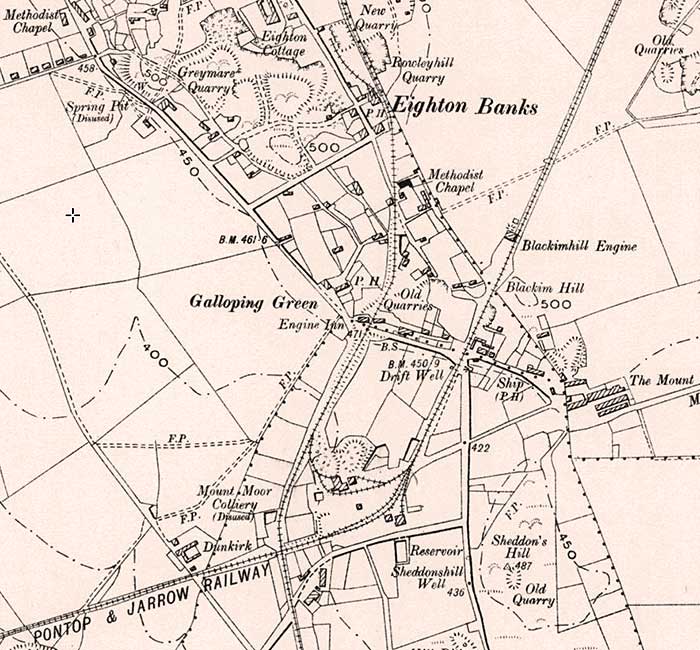
Sheddon's Hill & Eighton Banks
[ OS Map: 1888 - 1913 ]
Mount Moor Colliery (aka Vale Pit) is described as disused on the above map.
The Durham Mining Museum website lists it as opening before 1826 and closing in May 1931.
The Pontop & Jarrow is usually referred to as The Bowes Railway.
The railway crossing it at right-angles is the Ouston / Pelaw Main Railway.
Sheddon's Hill and Blackfell Hauler viewed from Mount Moor.
Huge Bonfire on Sheddon's Hill
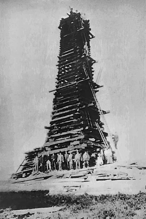
BONFIRE TO CELEBRATE THE CORONATION OF EDWARD VII - 1902
[ Photograph: Courtesy of Washington History Society. ]
• • ◊ • •
• • ◊ • •

• • ◊ • •
CELEBRATIONS PLANNED FOR WASHINGTON SCHOOLCHILDREN
[ Press Cuttings: Courtesy of Washington History Society. ]
• • ◊ • •
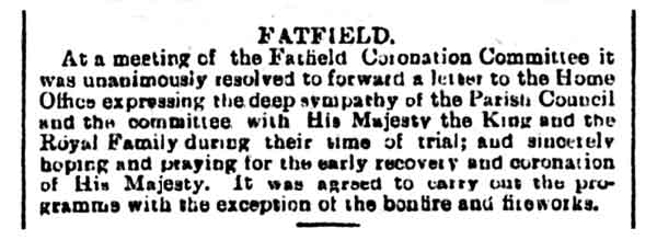
WHY WAS LIGHTING THE BONFIRE DELAYED?
THE KING
Albert Edward, the eldest son of Queen Victoria and Prince Albert, was born at Buckingham Palace on 9th November 1841.
He succeeded to the throne in 1901. He was well known as a lover of good food and wine, clothes, racing, gambling and ladies. In 1871 he fell seriously ill with typhoid but eventually recovered.
THE QUEEN
He married Princess Alexandra of Denmark at St George's chapel Windsor on 10th March 1863.
WHY WAS THE CORONATION POSTPONED?
Their coronation day was set for 26th June 1902 and guests were invited from all over the world. However, the King suffered an appendicitis a few days beforehand and developed peritonitis: unless he postponed the coronation and had an operation immediately he would die.
The King, though hugely reluctant, finally relented, and 9th August was chosen as the new date. By then he was much recovered and the service proceeded as planned.
[ Above Quotations: Thanks to www.westminster-abbey.org/abbey-commemorations/royals/edward-vii ]
CONFIRMATION OF BONFIRE LOCATION
Celebrations for Queen Victoria's Diamond Jubilee in 1897 included a giant bonfire on Shadon's Hill. The Coronation of King Edward VII and Queen Alexandra in 1902 was also marked by a monster bonfire after a day of children's sports.
[ Above Quotation from H. Letch (Birtley): Thanks to www.gatesheadlocalstudies.com ]
• • ◊ • •
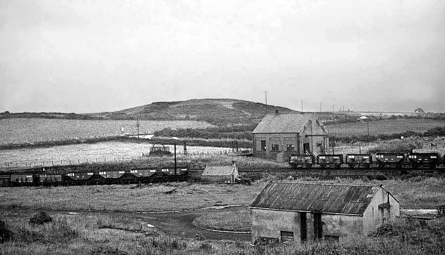
Sheddon's Hill as seen from the Ouston / Pelaw Main Railway at Eighton Banks, Bank Head.
Engine House: off-picture, left. Up the road to The Mill House. Down the road to The Ship Inn
The Map shows this Pelaw Main Railway curve, just north-east of the Engine Inn.
[ Photograph supplied by former Bowes Railway Museum volunteer, Malcolm Young. ]
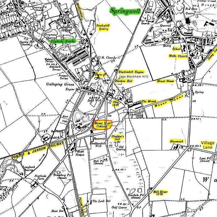
Map showing the area around Mount Moor Colliery.
Note the Hauler (Engine) House on the Pelaw Main Wagonway.
[ Ordnance Survey maps spell it as Sheddon's Hill but, as kids, we always pronounced it Shadon's Hill. ]
The Mill House Hotel
... looking South-East.
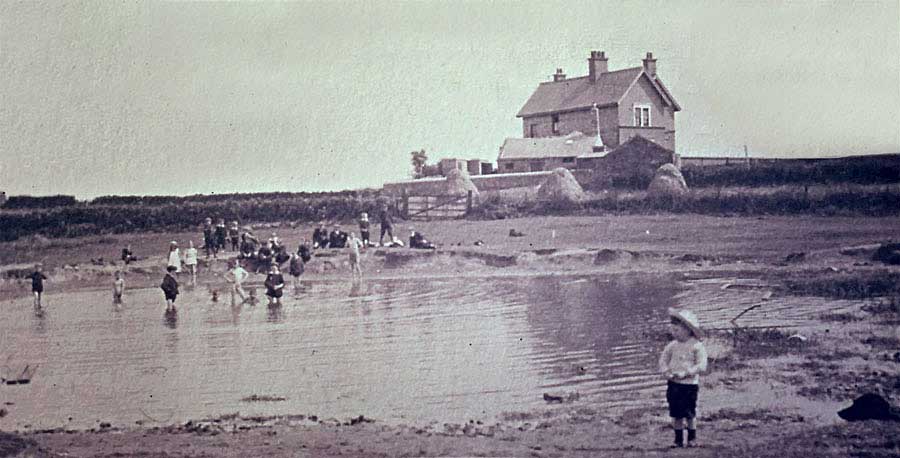
THEN
The Mill House Hotel seen across the fields from the road to Eighton Banks. Sheddon's Hill is off-picture, left.
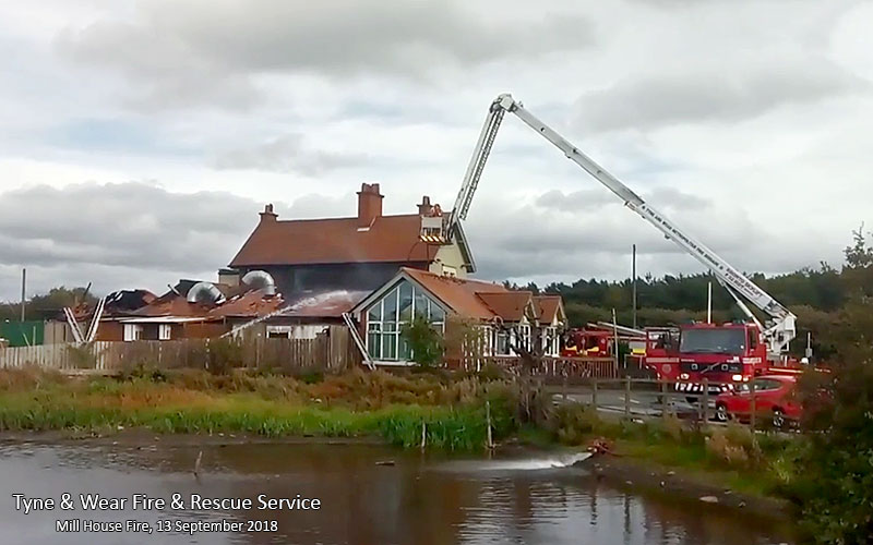
NOW
Mill House staff and customers evacuated as 26 Firefighters tackle major blaze.
[ Image posted by Tyne & Wear Fire & Rescue Service, 13th Sept 2018 ]
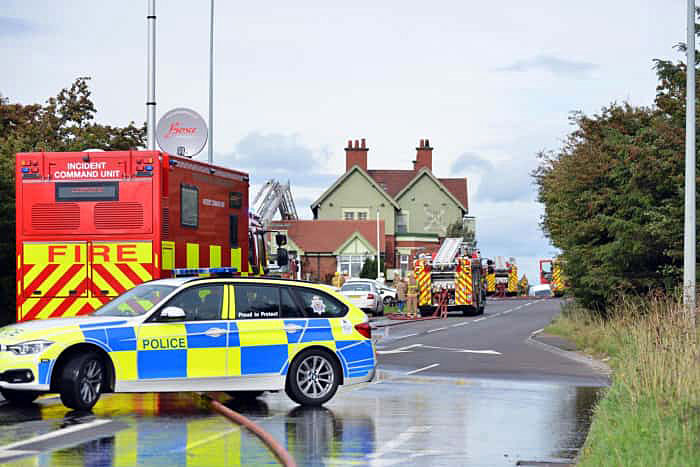
NOW
Emergency Services at the Scene.
[ Image posted by The Sunderland Echo, 13th Sept 2018 ]
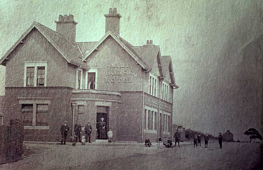
THEN
The Mill House Hotel